
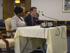
Clean Air Council Transportation Program Director Nick Zuwiala-Rogers spoke at a policy hearing held to address the rising numbers of vehicle related pedestrian deaths and injuries. Senator Sabatina’s district surrounds part of Roosevelt Boulevard which is regarded as one of the most dangerous roads in the country. Read our full testimony below.
(Philadelphia, PA–April 5, 2019)–Thank you for the opportunity to present testimony on behalf of Clean Air Council today. My name is Nick Zuwiala-Rogers and I am the Transportation Program Director at Clean Air Council. Clean Air Council sponsors Philadelphia’s pedestrian advocacy organization, Feet First Philly. The Council and Feet First Philly are members of the Vision Zero Alliance, a diverse coalition working to reduce traffic deaths to zero.
The Council is a member supported environmental advocacy organization whose mission is to protect everyone’s right to a healthy environment. Because transportation is the leading contributor of greenhouse gas emissions, the Council has a major focus on promoting sustainable forms of transportation, including walking. Feet First Philly works to promote walking as a form of transportation and recreation, protect the rights of pedestrians, and improve the pedestrian experience in Philadelphia.
News reports from earlier this year showed that pedestrian deaths in Pennsylvania were up 41% in the first half of 2018 over the same period in 2017, raising widespread concerns. While this trend is alarming, a lack of pedestrian safety is nothing new. Based on the last 5 years of publicly available crash data, pedestrians are 4-5 times as likely to be killed in a crash than non-pedestrians. On state roads, this increases to 6.5 times as likely for pedestrians to die in crashes. While state roads and local roads make up about the same number of crashes involving pedestrians, 75% of the ones that result in a fatal injury are on state roads. I say this to highlight the importance of the state taking a lead role in ensuring pedestrian safety. Local municipalities like Harrisburg, Bethlehem, and Philadelphia are engaging in Vision Zero policies, and the state should be a leader in these initiatives. This statistic also highlights that the most dangerous places to walk are the arterials that connect people to jobs, commercial corridors, healthcare, and public transit options. These state roads that are so critical to mobility are the same ones that are engineered with cars in mind first, and often provide no safe way for people to walk. This presents a clear and unfortunate equity issue where the lives of those who cannot afford a car matter less.
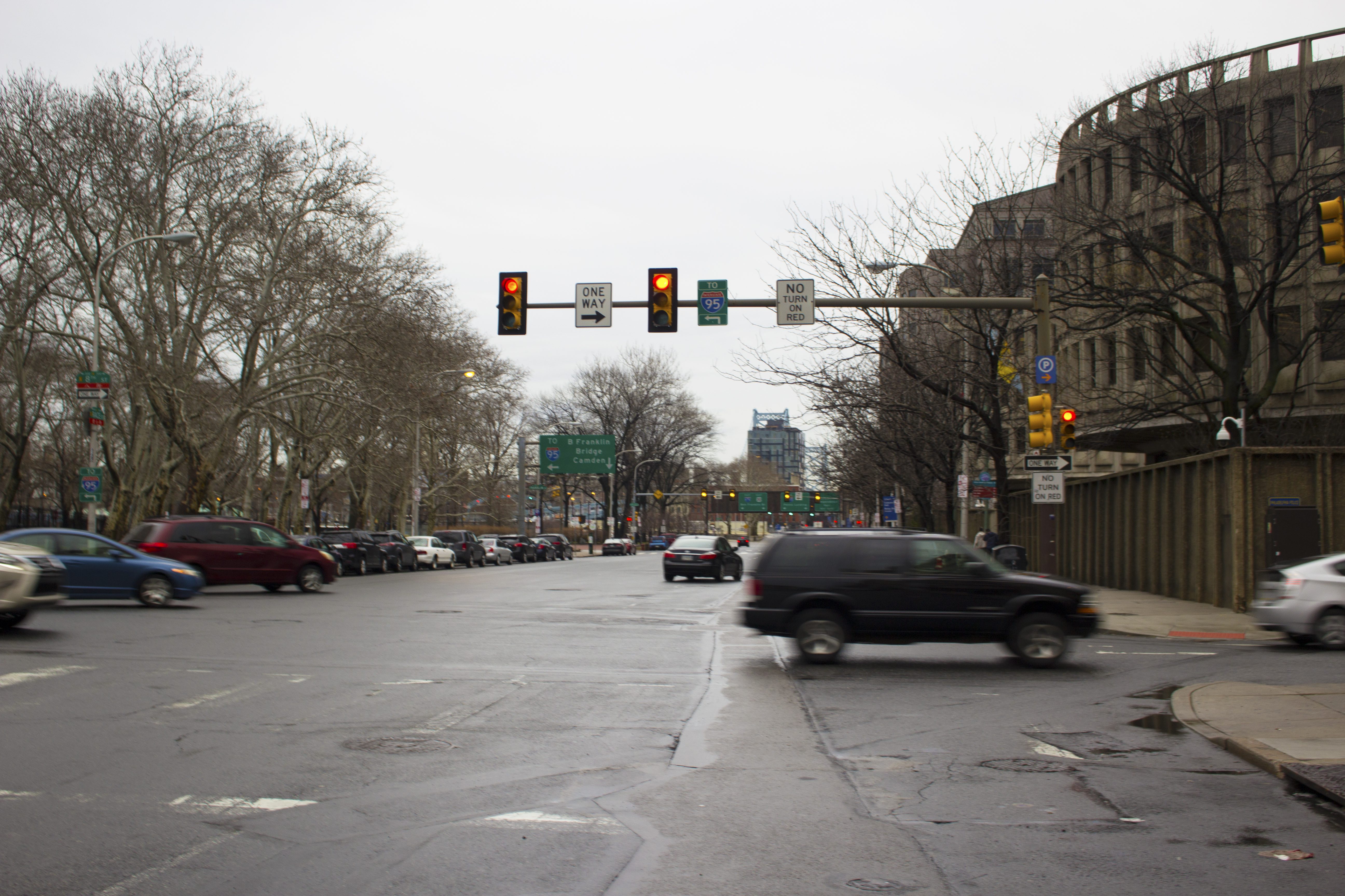
It is fitting we are holding this hearing in Northeast Philadelphia, not far from Roosevelt Boulevard, one of the deadliest roads in the country, which has been unfortunately referred to as “the Boulevard of death.” Roughly one person dies on this road every month, and about half of those people are pedestrians. On this road, last year, the state voted to allow an automated speed enforcement pilot in order to decrease the loss of life here. Expanded use of automated enforcement techniques, including for running red lights and speeding, are some of the tenants of Vision Zero that have worked well in other places. Vision Zero is the concept that fatalities as a result of traffic violence are avoidable, and none should be acceptable. The policy focuses on reducing traffic deaths to zero, with a focus on the most vulnerable road users – pedestrians.
Another tenant of Vision Zero is how we engineer our roads. Being a pedestrian can be a daunting experience, particularly on state roads where pedestrians are so much more likely to be killed. These roadways are clearly designed for cars not people, which is fundamentally wrong in my opinion, and I will guide you through the pedestrian experience walking in Pennsylvania. Being a pedestrian on a state road means you likely will not have a safe space to walk, like a sidewalk. Instead, you might be walking directly beside cars traveling at high rates of speed that will kill you in the event of human error. Even if you do have a sidewalk, you might have to walk up to a mile to the nearest safe crossing. When you get there, there may or may not be a crosswalk. If there is one, there is a good chance it is blocked by a parked car, or a car who did not stop behind the stop bar, as is the norm. When you get the opportunity to cross in that crosswalk, you will now be competing with turning cars who will race to get through the intersection before you have a chance to establish your right of way. As you cross a wide arterial road, you will quickly start to run out of time and could be stranded on the median as cars speed by you, if you are lucky enough to find refuge space in the center of the road.
This experience is the result of decades of prioritizing designing roads to maximize how many and how fast we can move cars, and ignoring the safety of actual people. As a legislative body, you should task our state’s DOT with prioritizing safety over throughput – lives saved over moving as many cars as quickly as possible. Sometimes that means we get places a little slower, but that sacrifice means we save lives.
The good news is there are a few bills that are either already introduced, proposed in previous sessions, or soon to be introduced this year that can help to improve pedestrian safety. I will outline four of them here, and the ways they would protect pedestrians. Two of these bills will specifically target two of the most dangerous behaviors identified by PennDOT’s crash data – speed and distracted driving.
RADAR for Local Law Enforcement (previously SB 251) – Simply put, speed kills. A pedestrian hit at 40 mph has a 10% chance to survive. That number increases to 50% at 30 mph, and a pedestrian hit at 20 mph has a 90% chance to live. In the absence of other automated enforcement techniques, radar should be implemented as a minimum way for officers to objectively track speed. Pennsylvania is the only state in the country not to use this basic technology.
Hand Held Ban (HB 37) – Distracted driving is a major cause of pedestrian fatalities in the state, and is one of the most dangerous behaviors according to crash data. Preventing distracted driving from cell phone use is common sense. According to AAA, 85% of people think cell phone use is a threat to safety, and all of our northeast neighbor states have cell phone restrictions. The gravity of the danger cell phone use generates cannot but overstated, we cannot allow drivers to be distracted by these devices while operating on our public roadways any longer.
Vulnerable Highway User Protections (previously HB 1646) – PA has a minimum 4 foot law for passing cyclists, and this bill would put the same protections on pedestrians and other vulnerable road users, and raise the fines where careless driving results in the death of a vulnerable user. Vulnerable road users do not have the same protections as those in a vehicle, including air bags and other safety features. Many parts of the state do not have sidewalks, especially on the particularly dangerous state roads. When pedestrians are not afforded a safe distance when cars pass them, it creates a lack of human dignity and speaks to equity concerns of whose lives matter. An important piece of this legislation is that it considers the principle of Vision Zero that human error is inevitable, and we should control for it.
Protected Pedestrian Plazas and Pedalcycle Lanes (previously HB 1657) – Legislation is needed to allow cities like Philadelphia who are interested in implementing Vision Zero strategies to do so. One of the best ways to protect pedestrians is by installing protected bike lanes, which is often done by using parking as the protection area. This actually has a greater impact on pedestrian safety than bicyclists because it shortens the crossing distance of the road, allow pedestrians a “head start” to establish themselves in the crosswalk before turning cars, and overall calms speeds by narrowing the cartway.
In closing, I want to bring this back to the foundation of the issue, and that is people and their dignity. Everyone at some point is a pedestrian. People – whether, drivers, transit users, pedestrians, children, seniors, people with a disability – however they use the road, should have the dignity to know they can make it to work, or to a family member’s house, or to the store, and back home again without dying, no matter how they are getting to those places. Currently, that is not true for Pennsylvanians who walk in our public spaces. Pedestrian safety cannot wait any longer and requires this legislative body to take action.
Thank you for your time today, and I look forward to working with all of you to move these policies forward.
City Council unanimously passed two ordinances today allowing the Department of Streets to designate two bike lanes and an ordinance removing parking along the 8200 block of Torresdale Avenue in Northeast Philadelphia where the Pennypack Trail crosses.
This is a small step toward achieving the Mayor’s campaign promise and Vision Zero plan for 30 miles of bike lanes. So far there are two miles. The bike lane along Race Street will be protected between 8th and 6th Street, and continue as an unprotected lane between 6th and 5th.
The second bike lanes will be installed along Island and Enterprise Avenues in Southwest Philadelphia. Councilman Johnson issued this statement to Clean Air Council on the importance of this bike lane and his thoughts on future trail connections in his district:
“This bill is part of the ongoing collaboration between my office and OTIS to advance Vision Zero goals. My priority is making city streets safe and inclusive. This particular proposed ordinance is the result of collaboration between my office, the Philadelphia International Airport, and community and advocacy groups to improve street safety in Southwest Philadelphia.
I believe bike lanes are beneficial to the city as a whole and this will help cyclists commuting in Southwest. We have received support for the bill from the Bicycle Coalition of Greater Philadelphia and community groups, who were consulted during the bill’s drafting. In cases like this one, where there are not the same space constraints and traffic or construction levels you have in Center City, there’s more opportunity for solutions that work for everyone.
In terms of the East Coast Greenway, my mind goes immediately to the Schuylkill River Trail and our work to connect South Philadelphia and Southwest Philadelphia portions of the trail between Grays Ferry and Bartram’s Garden, as well as fill in the missing links of South Philadelphia to expand access to the trail. I occasionally bike the Trail myself and I understand firsthand the importance of safety while cycling in the streets as well as expanding our greenways.”
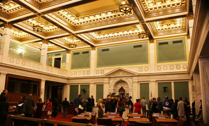
On Thursday, Councilman Mark Squilla, Chair of the Streets and Services Committee, introduced three bills on the Council floor proposing two new bike lanes, and eliminating parking along Torresdale Avenue where the Pennypack Trail crosses in Holmesburg.
This came a day after the Streets and Services Committee moved forward on the bills. According to Plan Philly, City Spokesman Mike Dunn told them in an email that he hopes the lanes will be open by the end of the year.
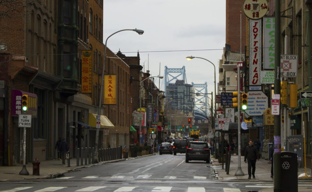
Race Street in Chinatown
One of the proposed bike lanes would be installed along Race Street between 8th and 5th streets in Chinatown. This particular corridor is heavily trafficked, especially during rush hour, with vehicles headed toward the Ben Franklin Bridge. Race Street turns from three to four lanes that are not clearly marked, adding to potential driver confusion.
The new lane would be parking protected from 8th to 6th, and would also create a much safer connection between Chinatown and Franklin Square, which is one of the only green spaces in the neighborhood.
Race Street at 8th Street looking East
The second bill is to install non-protected bike lanes in both directions along Island Avenue and Enterprise Ave in Southwest Philadelphia near the airport. These lanes will allow cyclists who work in this business and industrial area a safe path from nearby transit stops like the Eastwick Regional Rail Station.
The third bill, proposed in committee by Councilman Henon, removes parking along the 8100 block of Torresdale Avenue in order to allow Pennypack Trail users a clear place to cross the road. This is a wooded stretch of Torresdale Avenue is a key crossing point of the 14.4 mile trail that runs from Huntingdon Valley in Montgomery County all the way to Holmesburg in Northeast Philadelphia.
We spoke with Councilman Squilla briefly outside City Council chambers. “Councilman Henon introduced a bill, and we’re strongly in favor of the bill to allow the trail to continue,” Councilman Squilla said.” “I think it’s a great way to have more open space.”
All three of these are key to the success of Philadelphia’s Vision Zero plan. Safe connections like the Pennypack Trail at Torresdale Avenue will allow people to pursue alternative modes of transportation, and ease the pollution and congestion cars produce every day.
“This just lends the City’s upward motion to keep people who have different modes of transportation and ways of getting to different locations through this trail connector which is a great thing for not only the City but hopefully throughout the Commonwealth,” Councilman Squilla said. “Any time you can have dedicated trails, and people where they are put in a place where it’s safer to transverse, it definitely will help with our plan for Vision Zero.”
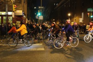
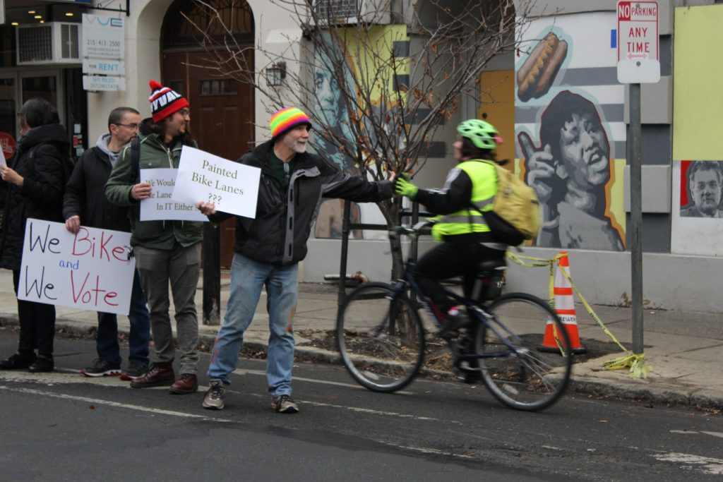
Exactly 17 days passed since Emily Fredricks was struck and killed by a private garbage truck while riding in the bike lane along Spruce Street before another cyclist was again struck by a turning truck while riding in a bike lane. This time the crash occurred near 13th and Pine Streets, just a couple blocks from where Fredricks was killed, and is once again igniting the call for more protected bike lanes throughout Philadelphia.
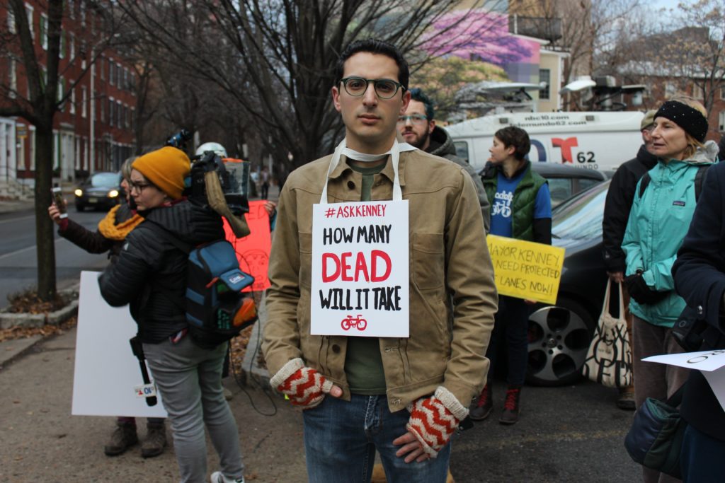
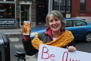
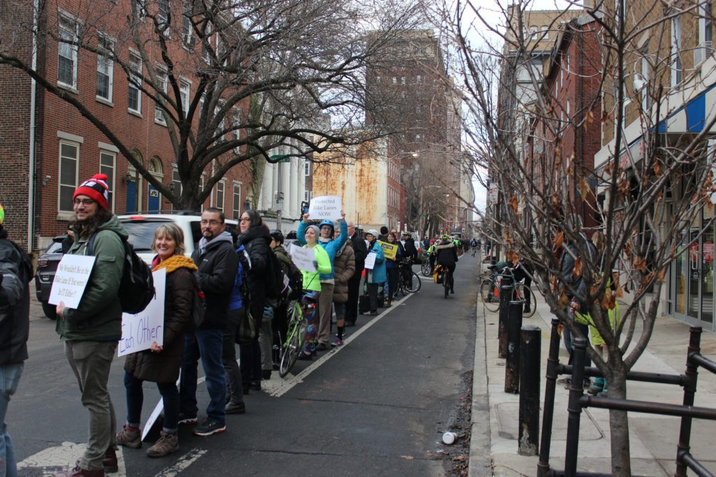
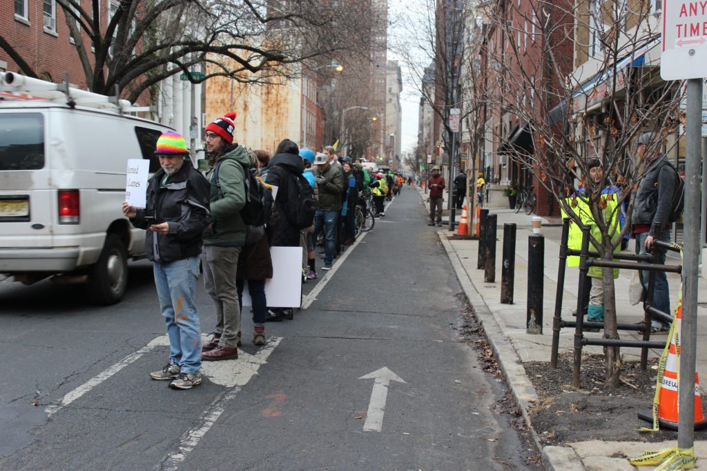
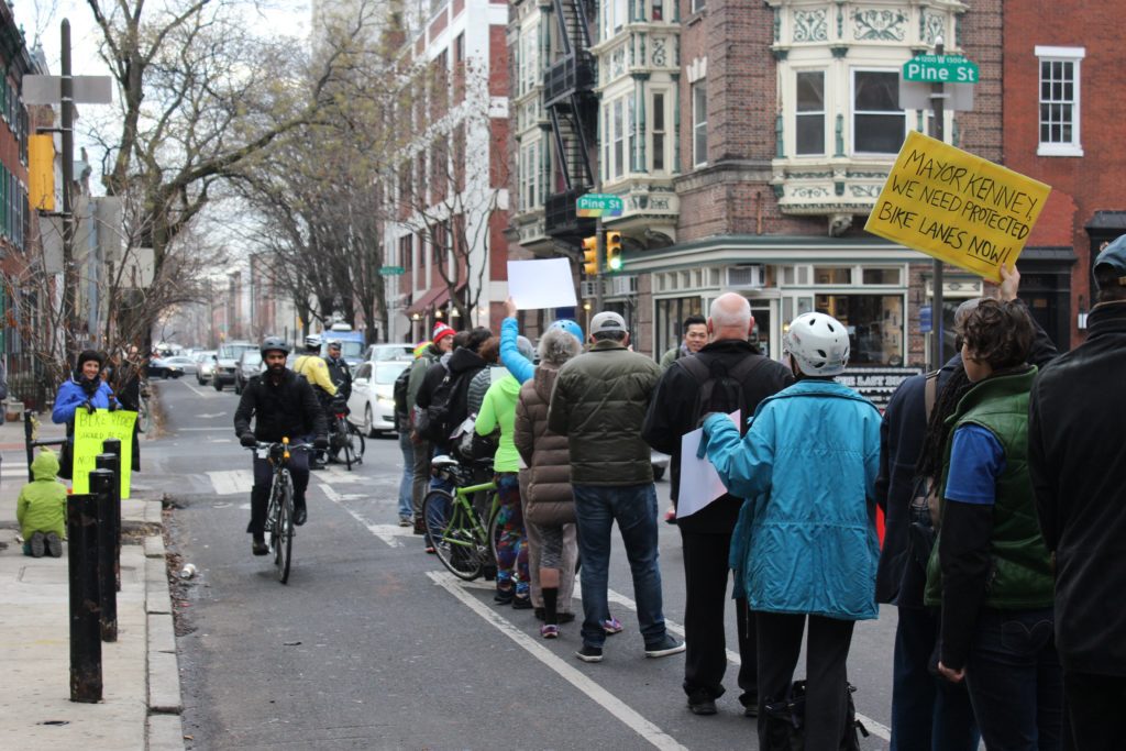
This morning, over 100 people gathered today to again form a human barrier between traffic and the bike lane along 13th Street, and show support for Becca Refford, 24, who was commuting to work when she was hit. Refford waved and smiled at the people who made the human bike lane from her hospital bed via Facetime.
Another serious crash so soon after the death of Emily Fredericks should make clear that paint-buffered bike lanes are not good enough protection on the most used, high traffic streets in Philadelphia.
Last week, the City took a small step by committing to a short section of protected bike lanes on South Street and 27th Street near the South Street Bridge. Unfortunately this is a compromise from the original plan to include a protected bike lane along Lombard Street as well.
Spruce Street, Pine Street, Lombard, and 13th Street are some of the most highly traveled bike lanes in Philadelphia. It is important that these roads be upgraded from lines of paint to physical barriers, the past three weeks have clearly demonstrated the need. Call Councilmen Kenyatta Johnson and Mark Squilla to thank them for the small addition to the City’s protected bike lane network, and demand that they take further steps to rapidly install protected bike lanes on all of center city’s bike lanes.
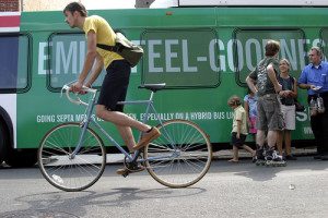
You may have heard that for the month of October, we, along with GoPhillyGo, Indego, and the Bicycle Coalition of Greater Philadelphia, will be celebrating bicycling across Philadelphia with the Love to Ride (LTR) Challenge, a fun, friendly, and free competition to get more people cycling. Increasing bicycling for daily travel is one of the primary goals of our work towards improving air quality in the region. Two of the common cited barriers to cycling include safety and riding, as in knowing where to ride or having other people to ride with. We seek to address these issues by increasing cycling infrastructure, making bicycle trip-planning easy, and advocating for safe streets for all. Read on to learn about our expansive work on bicycle infrastructure, education and advocacy.
Multi-use Trails
 We are a proud member of the Circuit Coalition – a group of non-profit organizations, municipalities, and government agencies that are working together to complete the region’s goal of 750 miles of connected multi-use trails. Currently, the Circuit Trails has over 300 miles complete, with about 100 more miles in progress. We are the lead on some of those in progress miles, including the Cobbs Creek Connector Trail and the Heinz Refuge bike/pedestrian connections.
Cobbs Creek Connector Trail
The Cobbs Creek Connector Trail will help complete the Cobbs Creek Trail, a key segment of the East Coast Greenway, and will be an important link between communities to recreational areas and historic sites, like John Heinz Wildlife Refuge at Tinicum (JHNWR), commercial hubs and employment centers. The Connector Trail will run approximately 3 miles from Cobbs Creek Trail’s current southern terminus to the JHNWR, spanning 4 main sections. Click here to learn more about the 4 sections of the Cobbs Creek Connector Trail.
Heinz Refuge Bike/Pedestrian Connections
We are partnering with JHNWR to build 3 additional pedestrian and bicycle friendly links in Philadelphia and Delaware Counties to JHNWR and businesses in the vicinity, including Philadelphia International Airport. Click here to learn more about these 3 connections.
Bike Racks
 Secure bike parking is one of the deciding factors on whether a person bikes to work or not. We recognized this several years ago, and since then have been helping businesses with the on-street bike rack permitting and installation process.
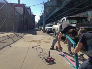
In 2016, we took on a new (to us) bike rack endeavor – the art rack. We were funded by the Penn Treaty Special Services District and the American Street Empowerment Zone to create and install 15 art racks as well as 10 standard inverted-U bike rack and a bike corral in the Fishtown, Kensington, and Northern Liberties neighborhoods. Art racks not only provide secure bike parking to employees and customers of businesses in these neighborhoods, but they also provide an appealing aesthetic that is as much place making as it is bike parking. These have been created by a local metal worker and have been an exciting asset to add to these neighborhoods.
As an extension of our work with bike racks, the Council was awarded an Azavea Summer of Maps fellow, who helped us analyze where bike racks already exist, how much they are being used, where illegal bike parking is happening, and ultimately design a way to predict how many bike parking spaces per employee or customer are needed in different situations.
Do you know a business that is interested in implementing secure bike parking? Have them contact Will Fraser, Sustainable Transportation Outreach Coordinator, by calling 215-567-4004 ext. 123 or emailing wfraser@cleanair.org.
GoPhillyGo
 GoPhillyGo.org is the region’s multimodal trip planner that we created to help make it easier to get around the Greater Philadelphia Area without a car. The website lets users plan biking, walking, public transit directions, or any combination of those modes of travel. GoPhillyGo also gives users the option to make their bike trip flatter, faster, or safer by using the customizable options. A very exciting new addition to the website is the Indego bike share functionality. Not only can you check individual station’s dock availability, but now you can plan a trip from start to end with seamless directions of which station to walk to, how to bike to the end station,you’re your final walking leg, just like taking transit!
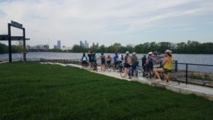
As part of GoPhillyGo, we organize bike rides for cyclists of all abilities to environmental centers and nature destinations. Just recently we explored the new Bartram’s Mile, a multi-use trail that goes through Bartram’s Garden, by bike. Subscribe GoPhillyGo’s eNewsletter to stay-up-to-date on our bike rides.
Vision Zero
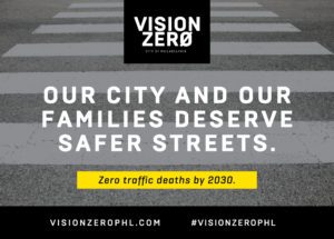 Finally, one of the most important ways we are working in Philadelphia as an advocate for bicycling is through the Vision Zero Alliance and the city’s subcommittees for Vision Zero. Vision Zero is the approach to traffic safety, first implemented in Sweden, based on the notion that no traffic death is acceptable. Cities that adopt Vision Zero policies have the goal of reducing traffic deaths to zero, and Philadelphia recently established their policy, with a goal of eliminating traffic deaths by 2030. The Council works with the City and other advocates to help this goal be met. In addition to Vision Zero’s importance for the dignity of all road users, there is a clear environmental relationship: as the most vulnerable of roadways users, people will not walk or bike for transportation if it isn’t safe.
What’s Next
Until we reach our Vision Zero goal of zero traffic fatalities and serious injuries, there will be crashes. While many major crashes are reported to police, there are many that are not. Soon we will be debuting a a web tool for reporting minor crashes and close calls. This data can help the City identify areas where improvements for road safety are needed. Remember to always report a crash that results in an injury serious enough to involve medical attention. But, for something minor, help us keep track of when and where those events are happening – stay tuned for Close Calls Philly.

GoPhillyGo.org, the free online mapping site for the greater Philadelphia area from Clean Air Council, has now released a mobile version for use on all mobile devices. Designed to make getting around without a car both easy and fun, the power of GoPhillyGo’s mapping technology will now be available on the go. You’ll be able to take the ultimate trip-planning tool for biking, walking and public transit with you—anywhere you go, any time you need it.
Developed with state-of-the-art open-source mapping technology from Philadelphia-based geospatial technology firm Azavea, GoPhillyGo makes it easy to plan a route through multimodal methods — combining biking, walking, and public transportation within one trip — to go anywhere within the greater Philadelphia area, its surrounding counties, and even into New Jersey without the use of a car. It provides details on pedestrian and bike routes and, on the bike segment of your trip, you can prioritize routes that are faster, flatter, or safer.
“Using GoPhillyGo on your mobile phone is a very exciting advancement for the website,” says Joe Minott, Executive Director of the Clean Air Council. “Obviously that is how so many people are accessing transportation information today, and I’m excited that planning non-car trips just became easier for people in Southeastern Pennsylvania. GoPhillyGo users can now explore some of the region’s most interesting nature-oriented destinations and quickly plan how they’ll get there on bike, foot, public transportation, or any combination.”
The new version of the website comes equipped with mobile functionality, a new look and sleek features, including drag-and-drop locations. Different modes of transport in your route now show up in different colors.
“Incorporating Indego bike share is the other big advancement we are excited about,” explains Nick Rogers, Transportation Program Director for the Clean Air Council. “This really makes planning trips with bike share much easier, and encourages people to use Indego as a transportation mode and not just a recreation activity.” Point-to-point Indego directions, dock locations, and bike availability are now included in the map, helping you get around by bike, even if you don’t own one.
“As a Philadelphia company dedicated to a positive civic and social impact, Azavea is thrilled to partner with the Clean Air Council to promote walking, biking, and riding public transit to our local institutions, parks, and other natural resources,” says Robert Cheetham of Azavea. “Now that GoPhillyGo has gone mobile, anyone in Philadelphia can easily explore the variety of destinations accessible to them. As a company full of bike enthusiasts, we are especially excited about the inclusion of Indego bike share locations into GoPhillyGo biking directions.”
Now, with GoPhillyGo mobile, you can get out of your house and just go. Covering five counties—including Philadelphia—and parts of New Jersey, the new mobile site allows you to plan ahead and take your route with you, change your plans on the fly, or figure it out as you go for a truly spontaneous adventure. Confidently explore Philadelphia; no car needed.
GoPhillyGo.org. Your destination ahead. Your map to getting there.
Clean Air Council is a member-supported, nonprofit environmental organization dedicated to protecting everyone’s right to breathe clean air. The Council has over 8,000 members and works in Pennsylvania, Delaware, and New Jersey on public education, community advocacy, and legal oversight and enforcement of environmental laws.
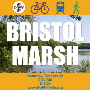
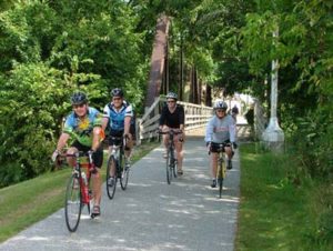
Get multimodal with GoPhillyGo on Saturday, October 22, as we combine SEPTA Regional Rail with bicycling to travel from Center City to Bristol Marsh, a GoPhillyGo featured destination, for an afternoon of bike exploration and nature walking.
We will begin the day at Suburban Station (16th St. & JFK Blvd) by taking our bikes on a reserved SEPTA Regional Rail car at 9:45 am to the Bristol Station. From there, we will bike-explore 15 miles of the Delaware and Lehigh Canal Towpath (D&L Trail). The D&L Trail, now part of the East Coast Greenway’s 3,000 mile bike-pedestrian trail from Maine to Florida, was once a major shipping route during the Industrial Revolution. This is no-drop, leisurely paced ride (10 – 12 mph).
After the ride, we’ll break for a complimentary lunch at Bristol Marsh. Lunch will be followed by a Heritage Conservancy-led nature walk through Bristol Marsh. Heritage Conservancy works as a local partner to The Nature Conservancy to promote the ecological restoration and stewardship of Bristol Marsh. Bristol Marsh is one of the few remaining freshwater tidal marshes along the Delaware River. It is home to six rare plant species native to the Delaware River Basin. After the nature walk, we will return to Center City at 2:11 pm by a reserved SEPTA Regional Rail car.
The cost of this event is $10*. The $10 covers your SEPTA fare and lunch. This event is limited to 15 participants.
Buy your tickets TODAY!
Go to registration page.
Fill in personal and payment information.
Select Other and enter $10. The $10 is an event fee, it is not a tax-deductible donation.
Under Anything else we should know, enter GoPhillyGo at Bristol Marsh.
Join the Facebook event page to stay up-to-date on the ride!
Registration deadline is Monday, October 17.
Bristol Borough-area residents, and those coming from outside of Center City are welcome to attend. To join the bike-exploration and nature walk, meet us with your bikes at the Bristol Station at 10:20 am. Please email Erika Reinhard at ereinhard@cleanair.org to let us know we should plan to meet you.
This is a self-supported ride, we highly suggest bringing a spare tube and repair kit. All riders must wear a helmet and follow the rules of the road. Please bring a lock to safely secure your bike while we are on the nature walk. We encourage riders to pay attention to the weather forecast and to dress appropriately. We also suggest wearing high visibility clothing and to bring a water bottle and snacks. Use of Indego bike share is not permitted. If you have a dietary restrictions, please contact Erika Reinhard.
*The $10 fee is not a tax-deductible donation.
For more information, please contact Erika Reinhard, Sustainable Transportation Outreach Coordinator, by calling 215-567-4004 ext. 111 or emailing ereinhard@cleanair.org.