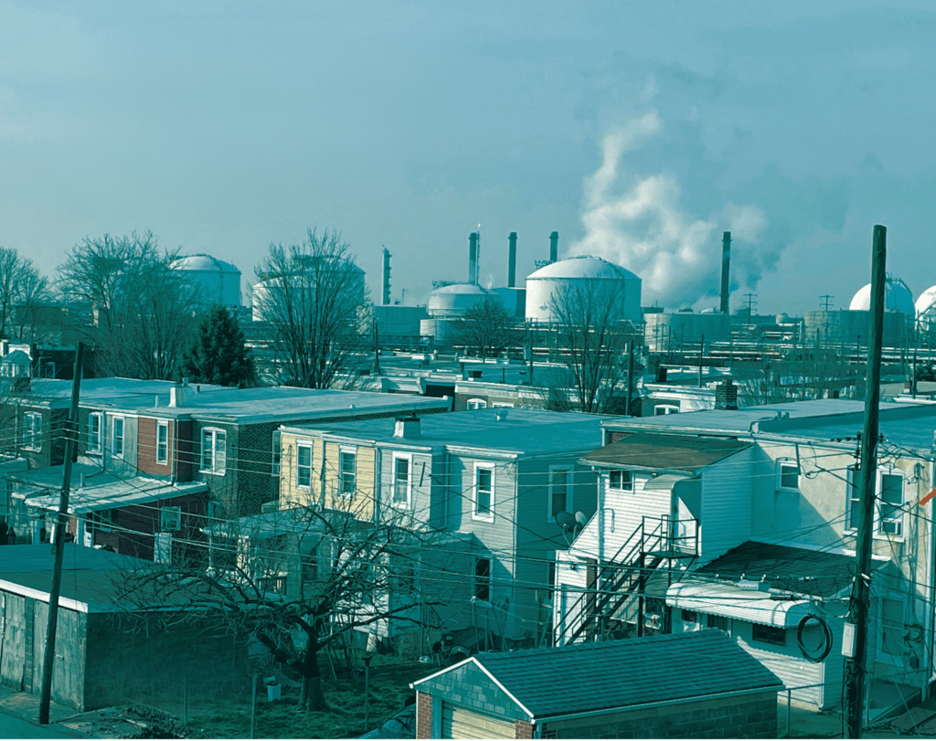
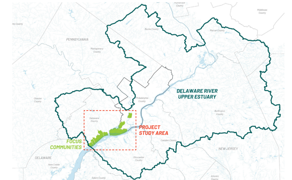
Residents of Pennsylvania’s Lower Schuylkill and Delaware River communities are confronting mounting hazards on multiple fronts. For decades, these hardworking communities have been essential to the economies of Philadelphia and Delaware Counties, living and working literally in the shadow of industry, transportation corridors, and beside the Delaware and Schuylkill Rivers.
Today, they face “natech hazards”— the compounded risks of natural disasters and industrial exposure that come from being located near both heavy industry and recurring floodwaters.
industrial facilities
and brownfield sites
vulnerable
communities
For decades, communities in Southeastern Pennsylvania disproportionately impacted by industrial pollution have advocated for environmental justice.
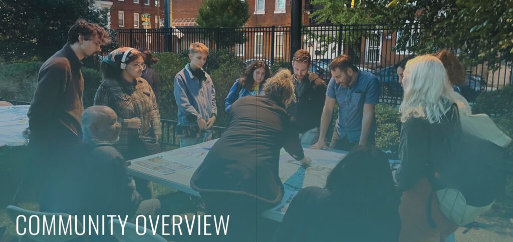
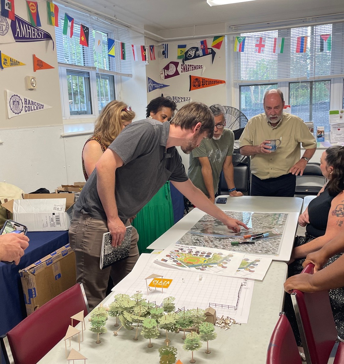
In 2022, Clean Air Council launched the Climate Resilient Communities Project to address climate risks in some of the region’s most industrialized and vulnerable communities. Partnering with Olin Labs, the Council analyzed climate, environmental, and community data, refined through engagement with local residents and leaders. Community input and resilience planning best practices informed the development of a climate resilience toolkit featuring local, regional, and policy recommendations.
The toolkit is tailored to each community’s unique needs, building on existing local plans while creating a shared framework to address climate change and environmental injustice. The project also developed and implemented small early-action projects with community partners to strengthen social resilience and demonstrate green infrastructure and other improvements needed to enhance long-term community resilience.
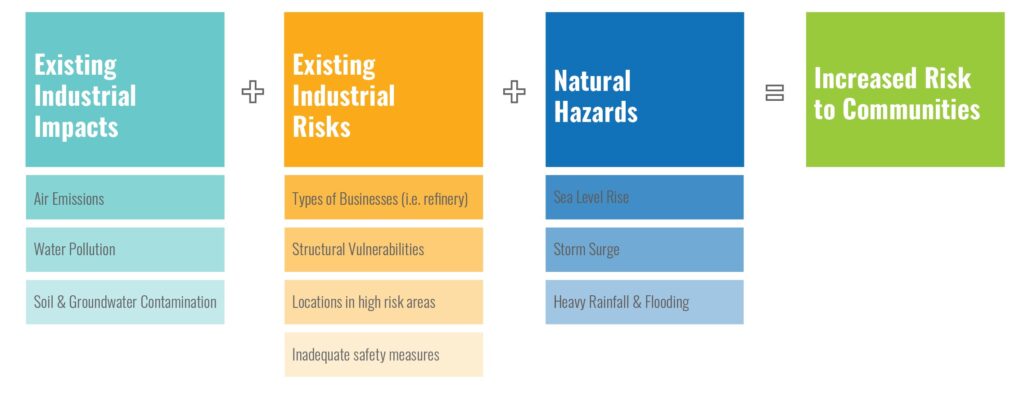
The report is structured around a simple but unacceptable equation: existing industrial impacts and risks + worsening natural hazards = increased risk to communities.
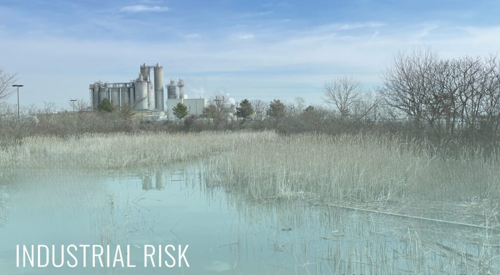
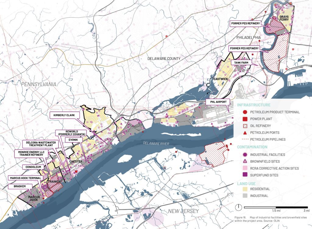
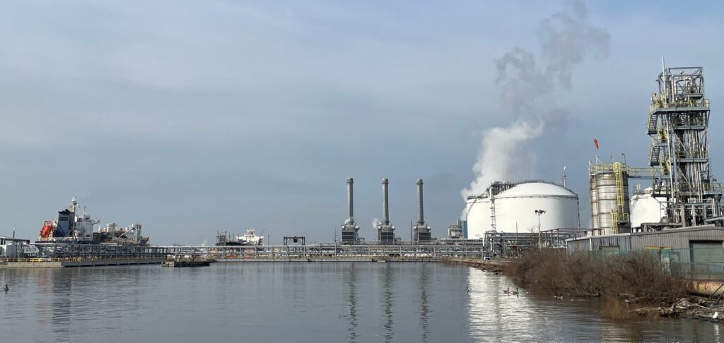
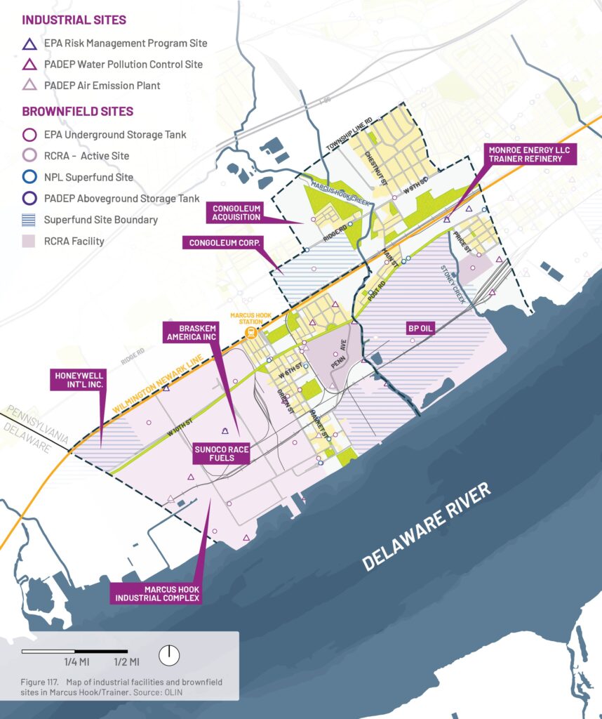
Within the study area, there are over 556 industrial facilities and brownfield sites regulated by federal and state programs for the use, manufacturing, processing, presence, or storage of toxic and hazardous chemicals. These sites impact the surrounding communities directly through exposure to toxic air emissions, water and soil contamination.
Industrial Facilities
For this study, industrial sites were defined as active facilities regulated under federal U.S. Environmental Protection Agency programs or Pennsylvania Department of Environmental Protection programs. These include facilities covered by the Risk Management Program, National Pollutant Discharge Elimination System, Toxic Release Inventory, Captive Hazardous Waste Facilities, Air Emission Plants, and Water Pollution Control Facilities.
Brownfield Sites
Brownfield sites are classified as sites that were previously active industrial facilities and have a high likelihood of past or continued pollution to the environment. These include the assessment, cleanup, and redevelopment exchange system and national priorities list superfund program, but also sites within the Resource Conservation and Recovery Act program and underground and aboveground storage tanks.
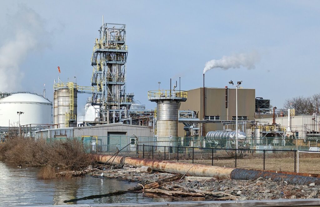
The industrial facilities within the study area include tank farms, petroleum refineries, oil and gas pipelines, chemical manufacturing and storage facilities, hazardous waste facilities, sewage sludge incinerators, and transportation corridors—including railroads, highways, and ports—that support the movement of hazardous materials. These facilities handle, transport, and store pollutants such as petroleum products, toxic metals, wastewater, and industrial chemicals.
All industrial operations carry an inherent risk of accidental releases, equipment failures, or operational incidents that can result in unpermitted discharges to the environment. The primary risks associated with these facilities can be broadly categorized as:
Existing Risks
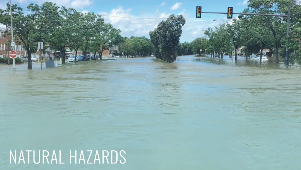
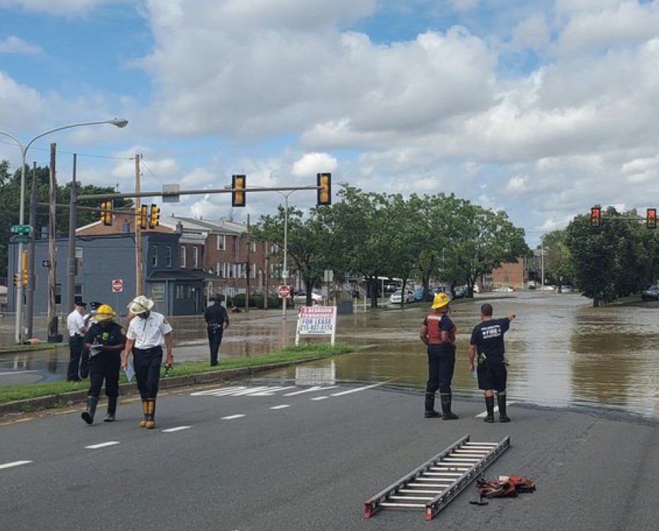
Between 2020 and 2022, the Philadelphia region was significantly impacted by tidal flooding events, hurricanes (Ida, Henri, Fred, Elsa, Isaias), tornadoes, quick-hitting winter storms, tidal flooding events, nor’easters, and other forms of severe weather.
According to the Federal Emergency Management Agency (FEMA), from 2011 to 2021, Pennsylvania declared a total of nine statewide “climate disasters,” requiring approximately $630 million in federal emergency response funds. Of those nine disasters, Philadelphia County declared five and Delaware County three.
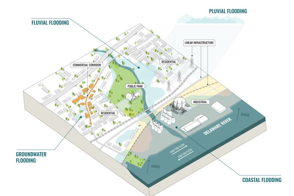
In the Philadelphia region, flooding can take many forms and has a variety of causes that drive where flooding occurs and at what depth and duration. While flooding is a natural occurrence along any river or coastline, it is particularly common in compound flood events that occur where rivers and the coastline (like the tidal Delaware River) converge.
Many communities along the Delaware River are also at the bottom of large tributary watersheds of the Delaware River, such as the Schuylkill River and Darby, Cobbs, Ridley, Chester, and Marcus Hook Creeks, making them also highly vulnerable to flash flooding from inland rain events.
Pluvial
Pluvial flooding occurs when rainfall exceeds the capacity of the ground, waterways, or stormwater systems to absorb and convey runoff. Often called urban flooding, it’s especially common in built areas with extensive impervious surfaces and limited drainage capacity.
Fluvial
Fluvial flooding occurs when water levels in a river, creek, or stream rise above the elevation of their banks and overflow into adjacent areas. Due to the close proximity of many communities, industries, and critical infrastructure to the region’s waterways, fluvial flooding is a common and significant flood hazard.
Coastal
Coastal flooding occurs when high tides and storm surge cause water levels in tidally influenced waterways, such as the Delaware and lower Schuylkill Rivers, to rise above normal levels and inundate adjacent land. Although wave action can exacerbate flooding, its effects are generally less severe in tidal rivers than in open coastal areas. Rising sea levels and land subsidence are increasing the frequency and extent of tidal flooding, including recurring “sunny day” flooding events that can occur without rainfall.
Groundwater
Groundwater flooding is caused when the water table rises to levels that cause inundation of the land surface or subterranean property such as basements.
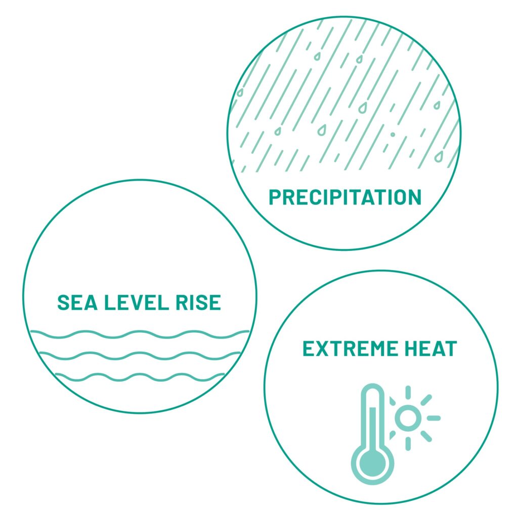
The communities along the Delaware and Lower Schuylkill Rivers are expected to become both hotter and wetter in the future through increased precipitation, rising sea levels, higher air temperatures, and more heat waves. Extreme weather is also projected to continue to increase in frequency and severity, leading to increased riverine and stormwater flooding.
Climate change will worsen existing environmental injustices in Philadelphia and Delaware County, with rising temperatures and flooding placing greater burdens on vulnerable communities. Understanding each community’s combined climate risks, vulnerabilities, and exposures is essential to building a more resilient region, population, and environment.
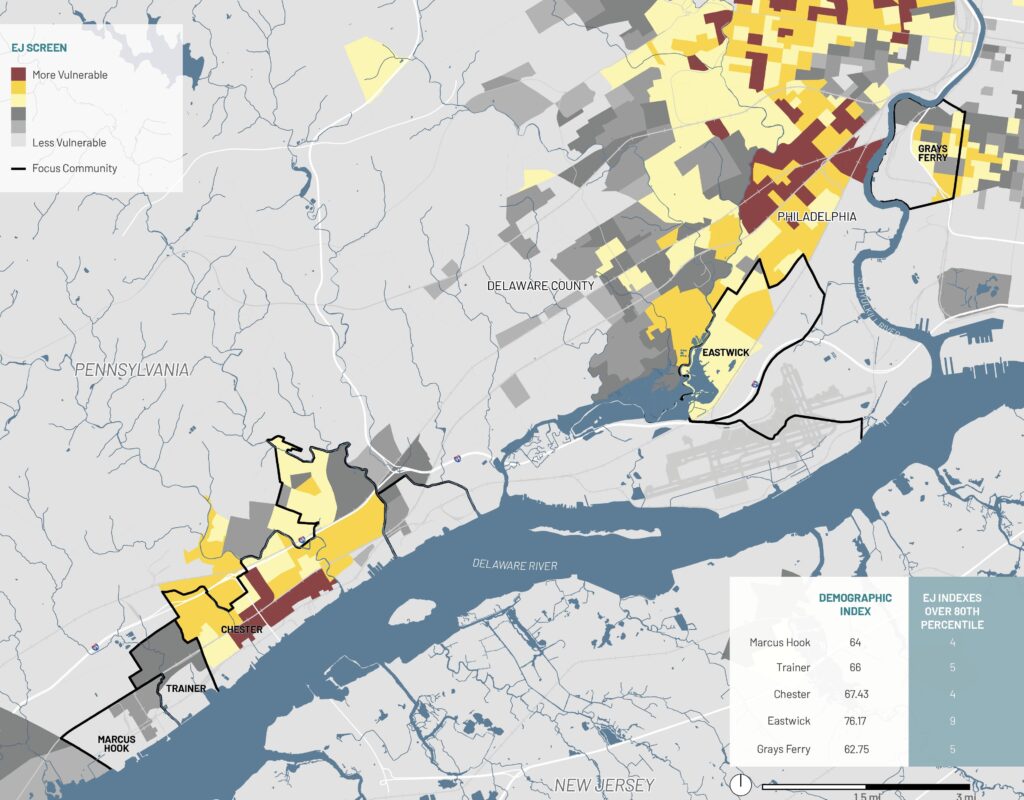
EJScreen is the EPA’s environmental justice mapping and screening tool at the national level, highlighting areas that have higher environmental burdens and/or vulnerable populations.
EJScreen provides demographic and environmental information and includes a method for combining them into environmental justice (EJ) indexes.
Areas emerge when they exceed the 80th national percentile for an EJ Index, which combines an environmental indicator with the demographic index (percent people of color x percent low-income).
Socioeconomic indicators:
Environmental indicators:
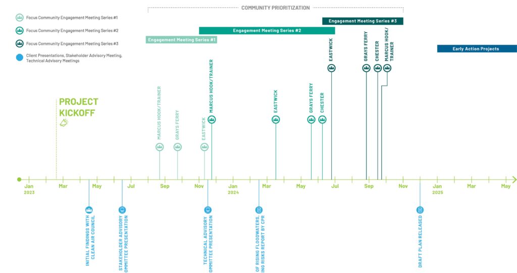
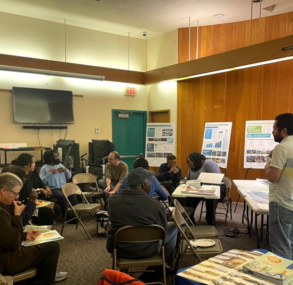
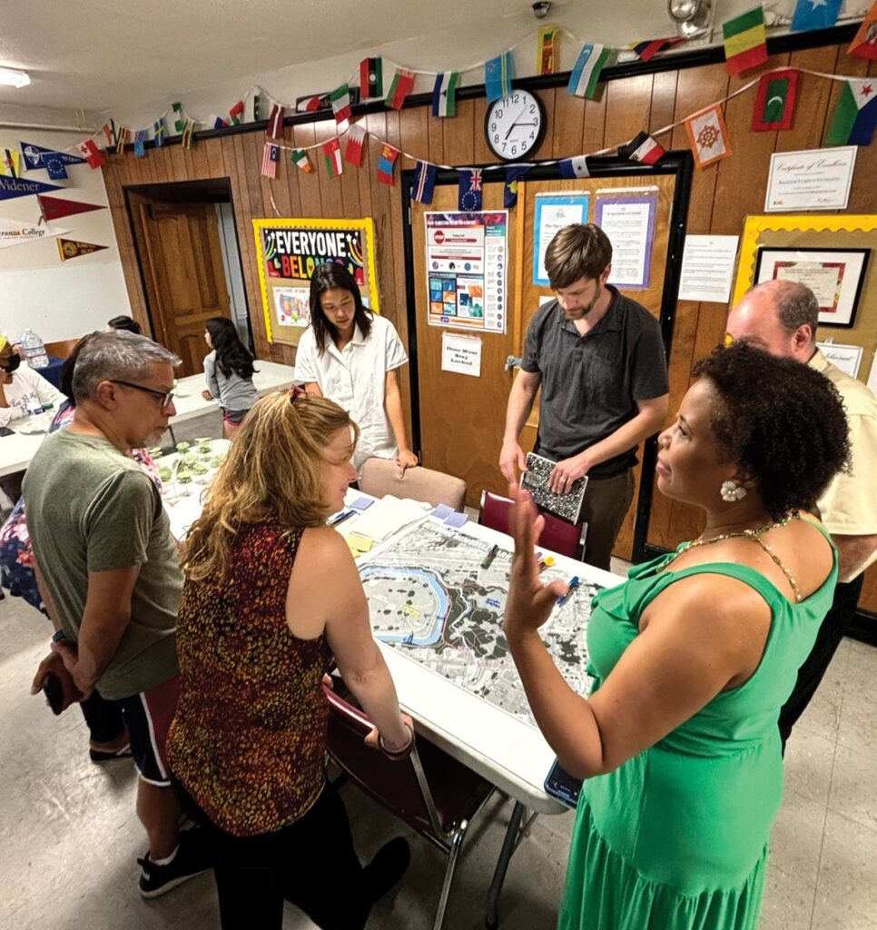
The process of developing recommendations for the project was deeply embedded in the five community focus areas and builds off of the decades of community organizing, planning, and ongoing advocacy of the people living and working there.
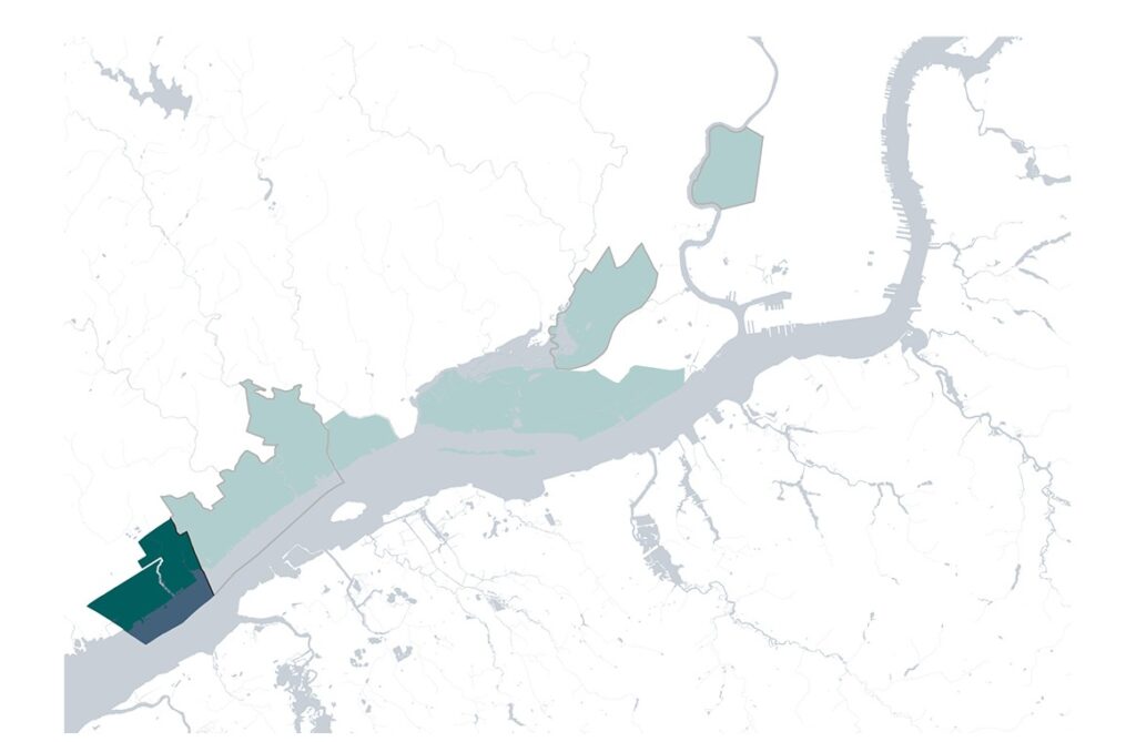
The adjacent boroughs of Marcus Hook and Trainer are located in the southernmost portion of the project boundary along the Delaware River.
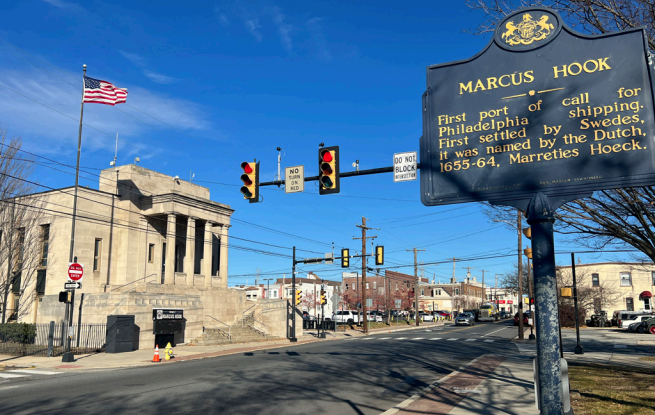
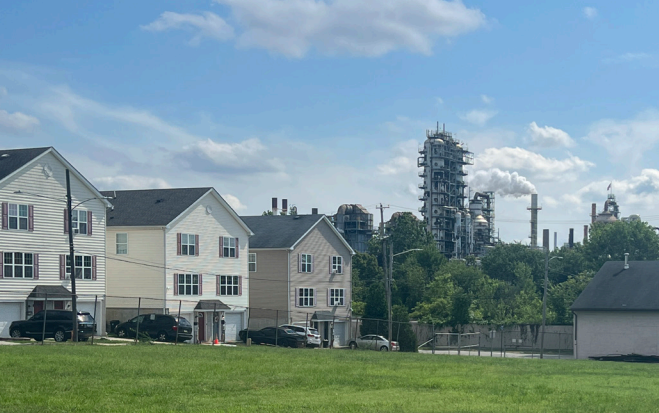
They share a deep history intertwined with industrial development. The industrial landscape continues to dominate both neighborhoods today, with active facilities lining the waterfront and industrial development right on residential borders.
Despite being smaller communities, Marcus Hook and Trainer are well into the process of building social capital and awareness around their environmental challenges.
Marcus Hook / Trainer By the Numbers
Population: 2,445 / 1,828
Density per square mile: 3,962 / 4,053
Median age: 38.6 / 36.2
Race and ethnicity: 16% / 30.5% Black; 7% / 7.2% Latino
Income: 16.7% / 18.3% below poverty line
Land use: 5.9% / 17.4% open space; 51.6% / 33.9% industrial
TRAINER
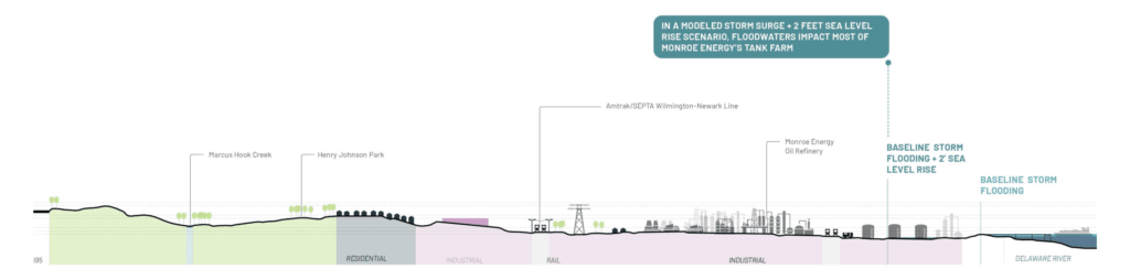
The majority of Trainer Borough is defined by its industrial waterfront and the various industries that occupy wide swaths of land, including Monroe Energy, an active oil refinery. Most residential land is set back from the water but abuts either the Amtrak/SEPTA regional rail line or active industrial land. There is no waterfront access in Trainer.
MARCUS HOOK
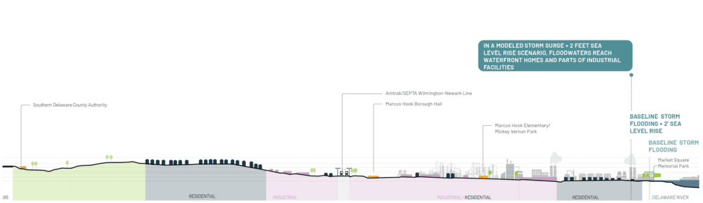
Like Trainer, Marcus Hook is characterized by active industry and large industrial facilities along its waterfront and inland. There is a pocket of residential land that runs from the rail down to the waterfront along Market Street, ending in a public park (Market Square Memorial Park). Residential and industrial land co-exist directly next to each other.
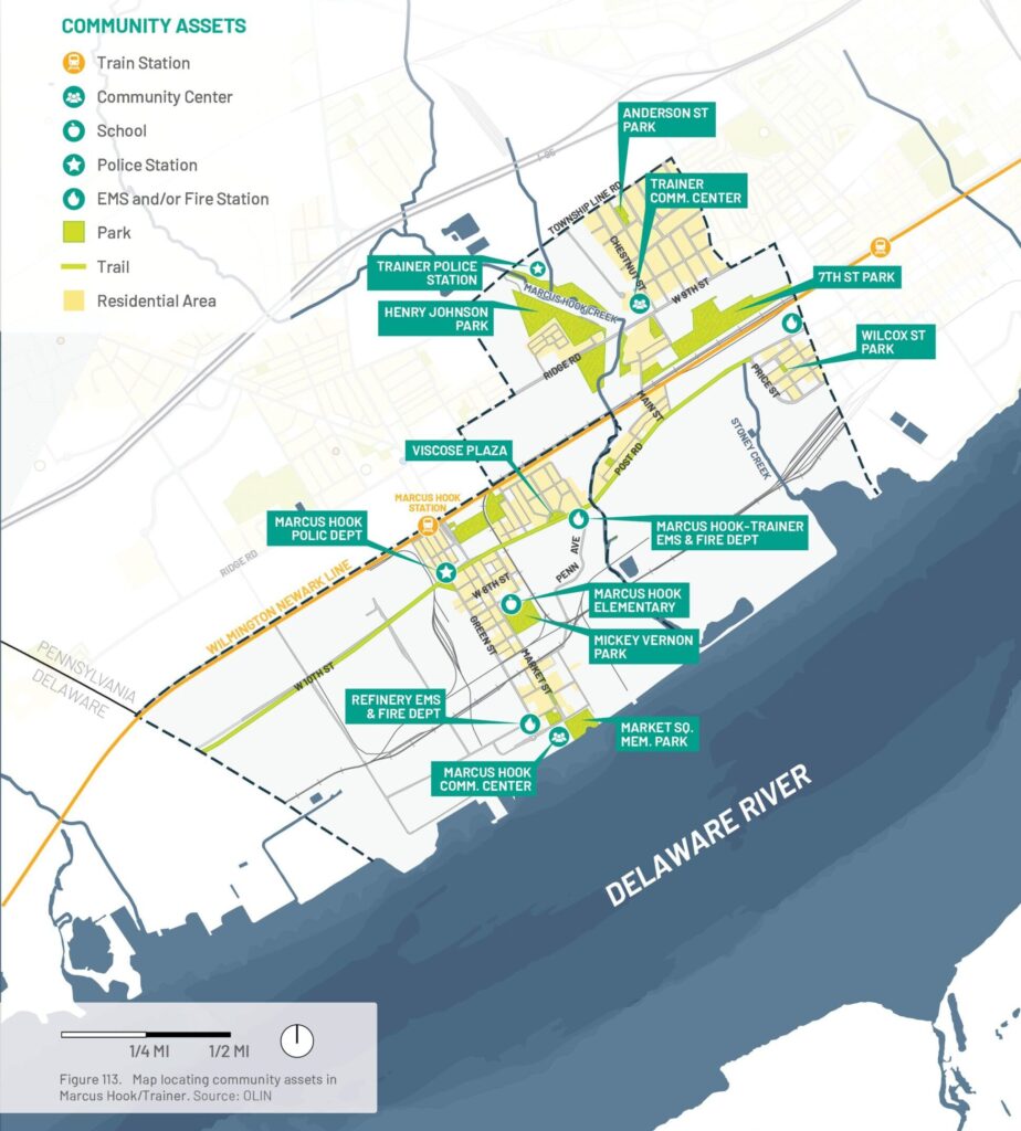
In Marcus Hook and Trainer, open spaces and residential areas are often located near industrial sites. Public spaces that are currently in use are few and disconnected. Market Square Memorial Park is one of the most active, offering waterfront access and fishing next to the Marcus Hook Terminal. Other sites include Mickey Vernon Park, a baseball field by Marcus Hook Elementary.
Although park availability is limited, residents have expressed interest in improving and better connecting existing spaces, such as Henry Johnson Park along Marcus Hook Creek. Some land could potentially be reclaimed for public use or flood mitigation, but challenges include limited access, possible contamination, and ownership issues.
Additional community assets include EMS facilities, fire and police stations in both boroughs, as well as a dedicated fire department serving industrial operations at the Marcus Hook Terminal.
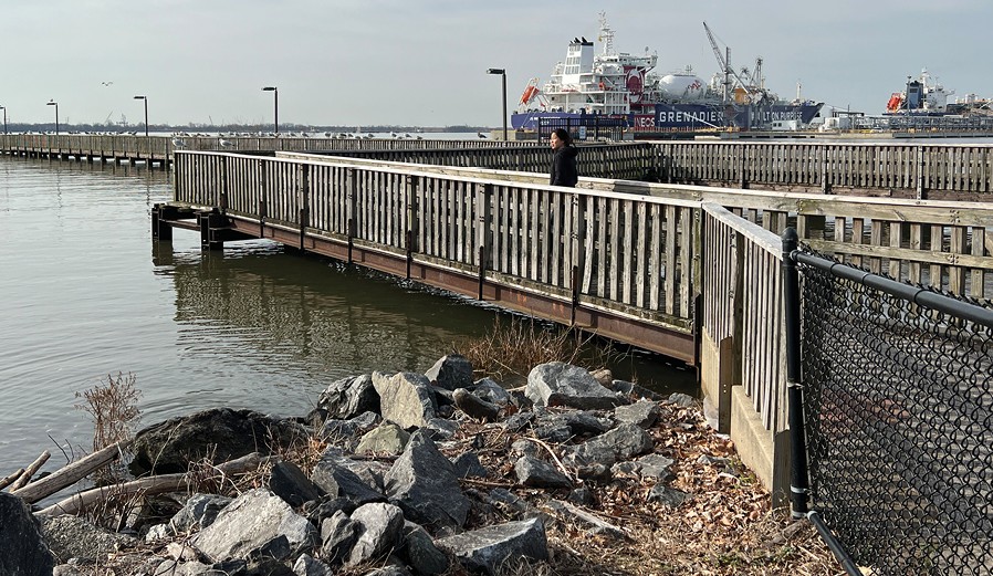
Industry dominates much of the land use and has a significant presence in Marcus Hook and Trainer. Many facilities are located next to waterways and/or residential land uses, posing significant concerns of Natural Hazard Triggered Technological Accident disasters with potential flood risks from storm surge and/or sea level rise.
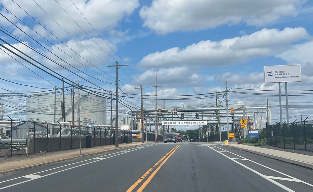
Marcus Hook Terminal
Formerly the Sunoco oil refinery site, this industrial complex is located on 788 acres along the Delaware River and has about 4,800 feet of waterfront frontage. Bordered by industrial land use and commercial/ residential properties, this facility is now primarily a natural gas liquids hub with pipeline connections to the Mariner East pipeline network. The facility currently has a Resource Conservation and Recovery Act (RCRA) operating permit for a hazardous waste storage area. Contaminants of concern include petroleum hydrocarbons, including concentrations of benzene, toluene, ethylbenzene, and xylene in groundwater.
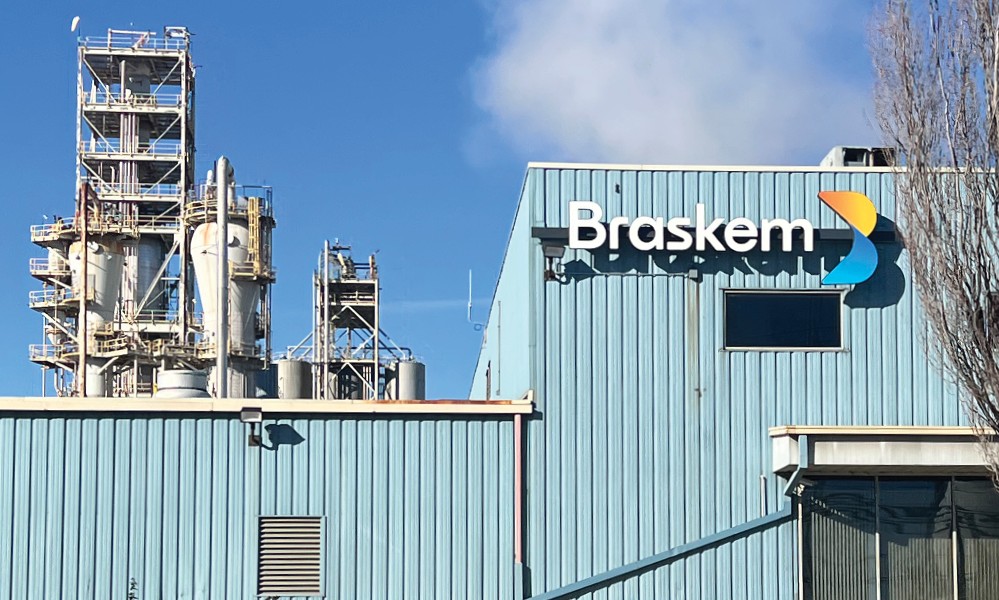
Braskem America
Braskem is a thermoplastic resins producer and one of the country’s main producers of polypropylene, a type of commodity plastic found in packaging materials, automotives, consumer goods, and other uses. In Marcus Hook, the company’s facility is used primarily to manufacture and process polypropylene. The facility is inland from the waterfront and immediately adjacent to Marcus Hook Terminal.
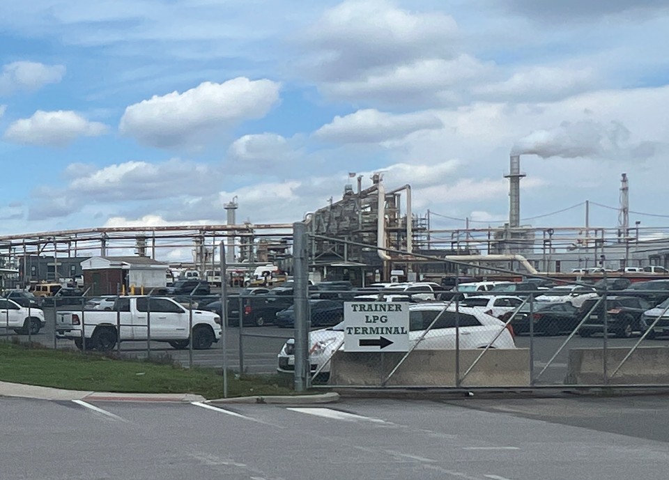
Monroe Energy Trainer Refinery
The 350-acre Trainer Refinery produces 185,000 barrels per day, primarily for jet fuel production but also for other petroleum products like gasoline, diesel, and home heating oil. The facility is located adjacent to Interstate 95 and Route 291, with Stoney Creek along its western and northern perimeters. Main contaminants found are typical hazardous petroleum products like benzene, ethyl benzene, total xylene, semi-volatile organic compounds, arsenic, chromium, and lead.
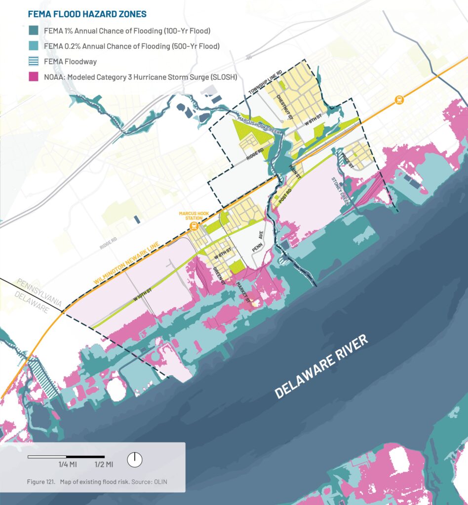
Current Mapped Flood Risk
What community features and industry are at risk of flooding?
Flood Risk
Marcus Hook and Trainer face multiple flood risks, including fluvial flooding from the Delaware River, Marcus Hook Creek, and Stoney Creek; coastal flooding from the tidal Delaware River; and groundwater and stormwater flooding in low-lying inland areas. Climate change is expected to worsen these hazards through sea-level rise and more intense rainfall. Recent storms, including Hurricanes Ida (2021) and Isaias (2020), caused minor coastal and moderate creek flooding, while Hurricane Sandy (2012) produced a record 10.14-foot storm surge at Marcus Hook, highlighting the potential for more severe coastal flooding in the future.
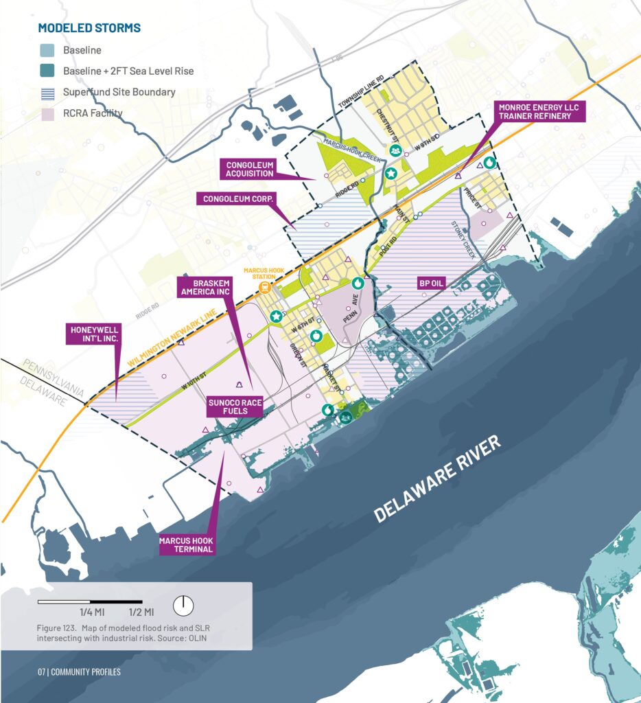
Future Flood Risk with Sea Level Rise
What community features and industry are at additional risk of flooding due to sea level rise?
Modeling of Hurricanes Ida (2021), Isaias (2020), and Sandy (2012) under a +2-foot sea level rise scenario shows that flood impacts are likely to expand in the coming decades, particularly along the Delaware River shoreline and creek corridors. While some areas experienced flooding during these past storms, rising sea levels are expected to increase the extent and severity of flooding during similar future events.
The greatest impacts are projected from storms comparable to Hurricane Sandy. Critical community assets at risk include the Curt Weldon Community Center and Market Square Memorial Park in Marcus Hook, as well as waterfront industrial facilities such as the Marcus Hook Terminal and the Monroe Energy Refinery in Trainer. These findings highlight the growing vulnerability of both community resources and industrial infrastructure to future coastal flooding.
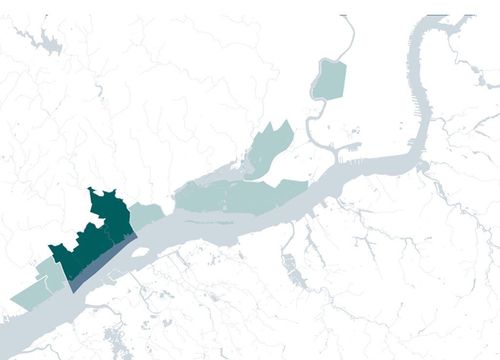
Chester’s story reflects broader patterns of American industrial development. It has undergone boom and decline, and continues to search for economic revitalization.
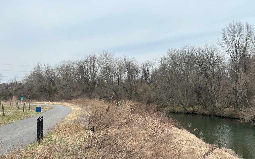
Chester’s location along the Delaware River made it an industrial and manufacturing hub for generations. In the late 1950s, Chester began an economic downturn. By 1980, the city lost one third of its jobs.
Chester’s industrial past is still evident in its landscape, with former shipyards, industrial waterfronts, and scattered factories and power plants. Like neighboring Marcus Hook and Trainer, this legacy remains complex.
As Chester emerges from bankruptcy, it can build on the work of community groups by implementing infrastructure and community benefit projects with climate adaptation in mind.
Chester By the Numbers
Population: 33,940
Density per square mile: 6,600
Median age: 31
Race and ethnicity: 85.3% non-white; 67% Black
Income: 28.5% below poverty line
Land use: 22% open space; 7.7% industrial
CHESTER WEST
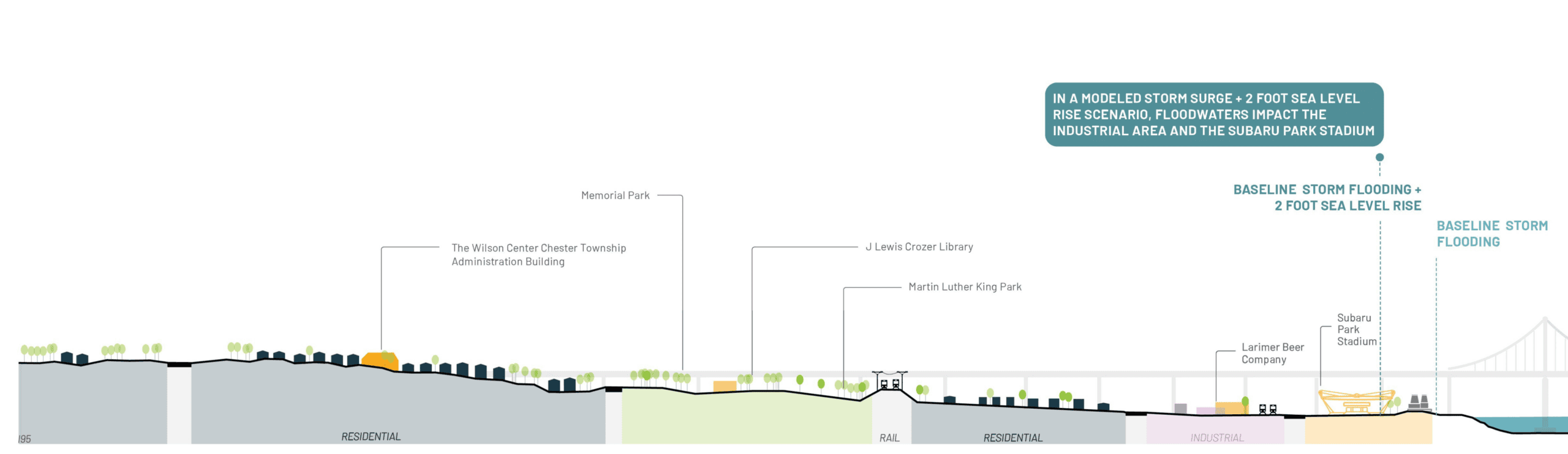
The Chester West waterfront includes a small industrial area and Subaru Park Stadium, both vulnerable to flooding. The industrial area borders a residential neighborhood, with both located between rail lines. Larger industrial areas lie farther inland beyond Martin Luther King Park and Memorial Park.
CHESTER EAST
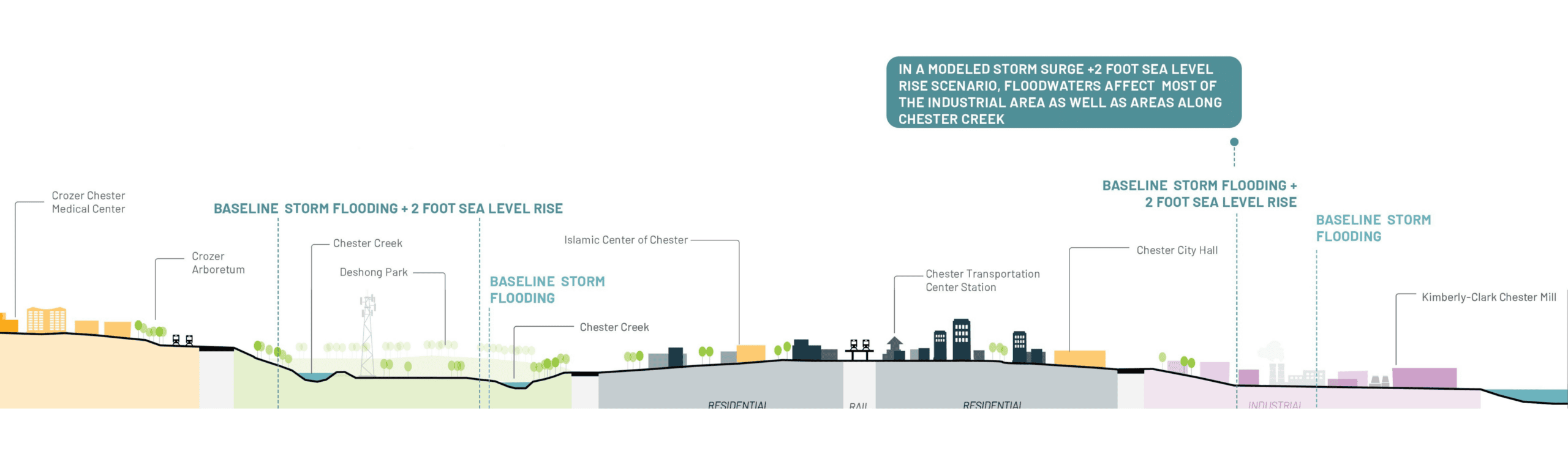
Chester East contains a larger, lower-lying industrial area than Chester West. Its downtown includes mixed-use residential pockets, major cultural and public institutions, and an elevated rail line. Beyond the residential area, Deshong Park is bisected by Chester Creek and bordered by the hospital district and Crozer Arboretum on higher ground.
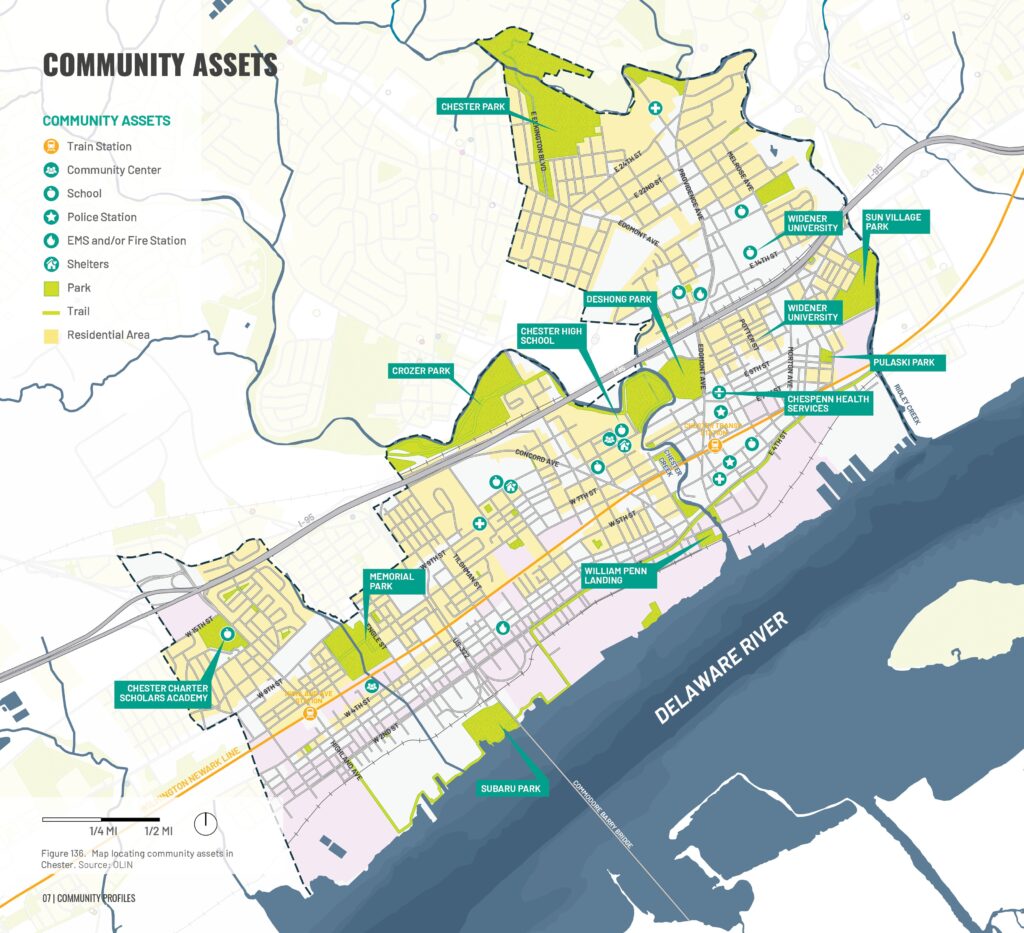
Chester contains 247 acres of parkland, including six major parks and 23 neighborhood play areas, connected to a broader network of green spaces along Chester and Ridley Creeks.
Residents have identified opportunities to improve park access, safety, programming, and underused spaces such as Deshong Park.
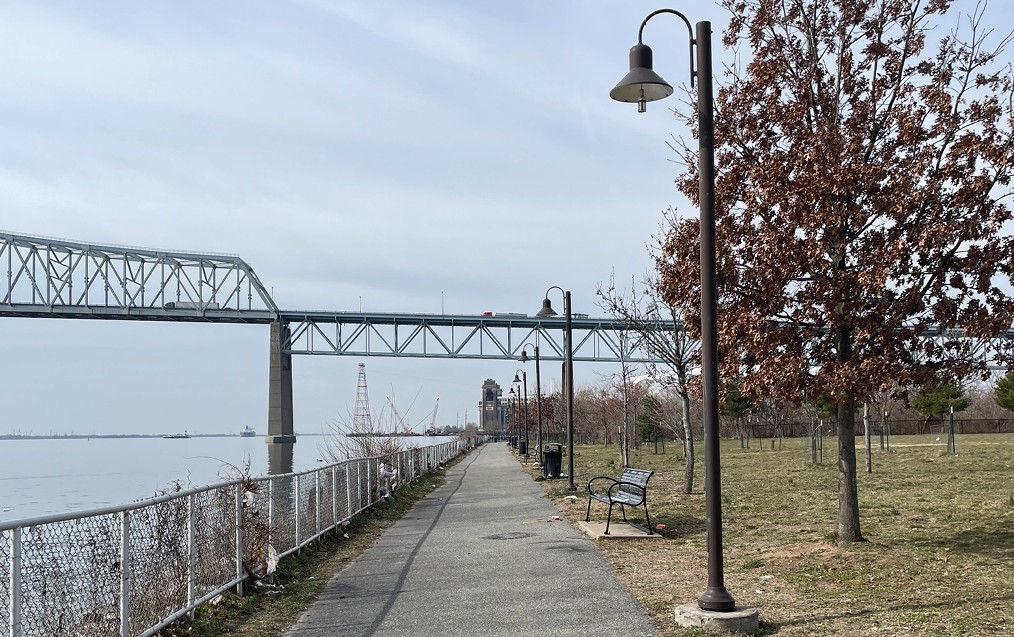
Chester also has one of the region’s most accessible waterfronts, anchored by Subaru Park and the 1.35-mile Chester Riverfront Trail, with plans to extend connections to the East Coast Greenway.
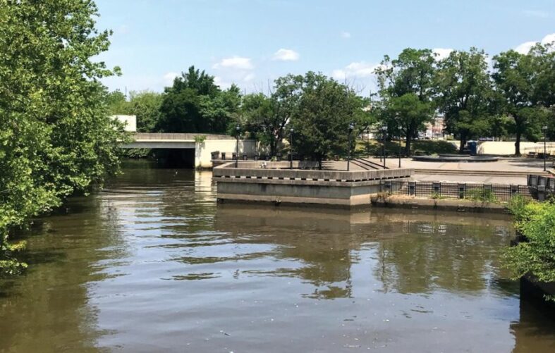
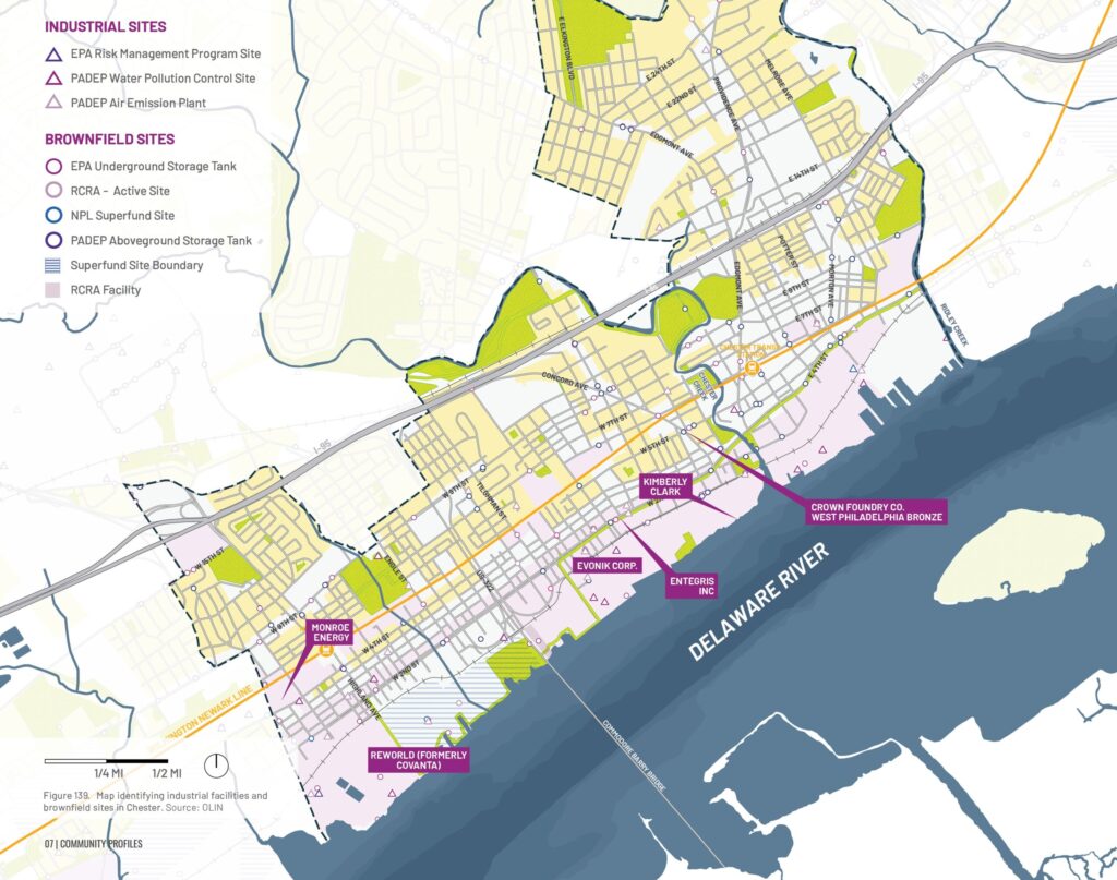
Like neighboring Marcus Hook and Trainer, many of Chester’s hazardous facilities are concentrated along the waterfront. This pattern emerged in the late 20th century, when industrial decline left large areas of vacant land, attracting hazardous and waste treatment facilities as regional landfill capacity diminished.
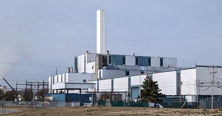
Reworld (formerly Covanta)
This waste-to-energy facility on Chester’s waterfront that processes over 1.23 million tons of municipal waste annually, with only 1.6% originating from Chester. Among the largest trash incinerators in the U.S., it has operated since 1990 and continues to emit pollutants such as nitrogen oxides, sulfur dioxide, and particulate matter. EPA data has identified the facility as one of the nation’s highest emitters of these pollutants among comparable facilities.
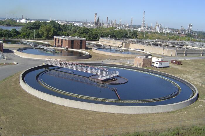
Delaware County Regional Water Authority (DELCORA)
DELCORA is a wastewater treatment facility serving the Greater Philadelphia region. Historically, the facility has exceeded pollution limits, including a 2015 settlement over untreated sewage discharges into the Delaware River. EPA estimates indicated hundreds of millions of gallons of untreated sewage were released annually, causing environmental and public health concerns. In 2024, DELCORA entered an agreement with the EPA and Department of Justice to significantly reduce sewage discharges and improve environmental compliance.
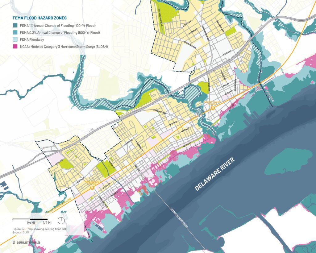
Flood Risk
Chester is vulnerable to flooding from several sources, including the Delaware River, Chester Creek, Ridley Creek, and heavy rainfall that can overwhelm low-lying areas. Climate change is expected to worsen these risks, with rising sea levels and more intense storms leading to larger and more frequent floods.
Current Mapped Flood Risk
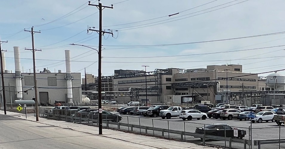
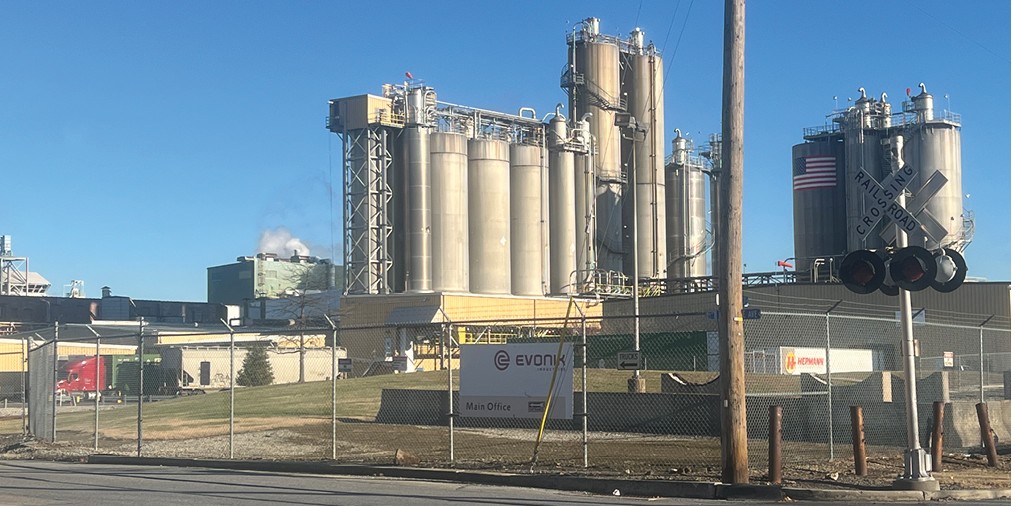
FEMA flood maps show the highest flood risks along the Delaware River waterfront and near Chester and Ridley Creeks. Flooding could threaten industrial facilities such as DELCORA, Reworld, and Evonik, raising concerns about potential chemical spills and other environmental hazards during major storms.
Most flood-prone areas near the creeks are vacant or open land, but some nearby homes are also at risk. Severe storms could push floodwaters farther inland, affecting additional residential neighborhoods. Important community assets, including the Chester Riverfront, Chester Community Charter School, and the Eddystone Fire Department, are also vulnerable to flooding.
Extreme Heat
Limited tree canopy, extensive paved surfaces, and air pollution contribute to higher temperatures across Chester than in surrounding areas. Climate change is expected to make heat waves more frequent, intense, and longer-lasting, increasing risks to public health and community well-being.
Flood Risk: Modeled Storms with Sea Level Rise
What community features and industry are at risk of flooding due to sea level rise?
Modeling of Hurricanes Ida (2021), Isaias (2020), and Sandy (2012) under a +2-foot sea level rise scenario shows that future flooding is likely to expand along the Delaware River waterfront and, to a lesser extent, along local creeks. Areas that flooded during past storms are expected to experience deeper and more extensive flooding as sea levels rise.
Low-lying industrial facilities and warehouses are particularly vulnerable, including Evonik, Kimberly-Clark, and Reworld (formerly Covanta). In addition to increasing flood hazards, future storm events may bring stronger winds and heavier precipitation, raising the risk of industrial accidents, hazardous material releases, service disruptions, and other impacts to nearby communities.
Eastwick’s history has been shaped by environmental challenges, redlining, urban renewal, and ongoing environmental injustice.
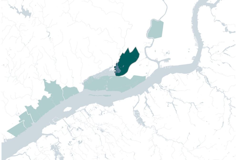
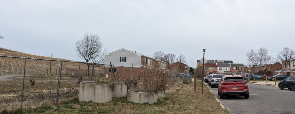
Originally home to the Lenni Lenape, Eastwick was once a vast landscape of marshes and wetlands that naturally absorbed floodwaters. Following World War II, federal urban renewal policies displaced thousands of residents, filled wetlands, and replaced them with housing, increasing the neighborhood’s flood risk.
Today, Eastwick remains vulnerable to flooding, worsened by climate change, while also facing pollution from nearby highways, Philadelphia International Airport, and industrial facilities. Eastwick continues to advocate for long-overdue investments in flood protection and environmental health.
Eastwick By the Numbers
Population: 12,000
Density per square mile: 6,000
Median age: 37.4
Race and ethnicity: 76% non-Hispanic Black; 4% Hispanic
Income: 24% below poverty line
Land use: 37.5% open space; 13.7% industrial
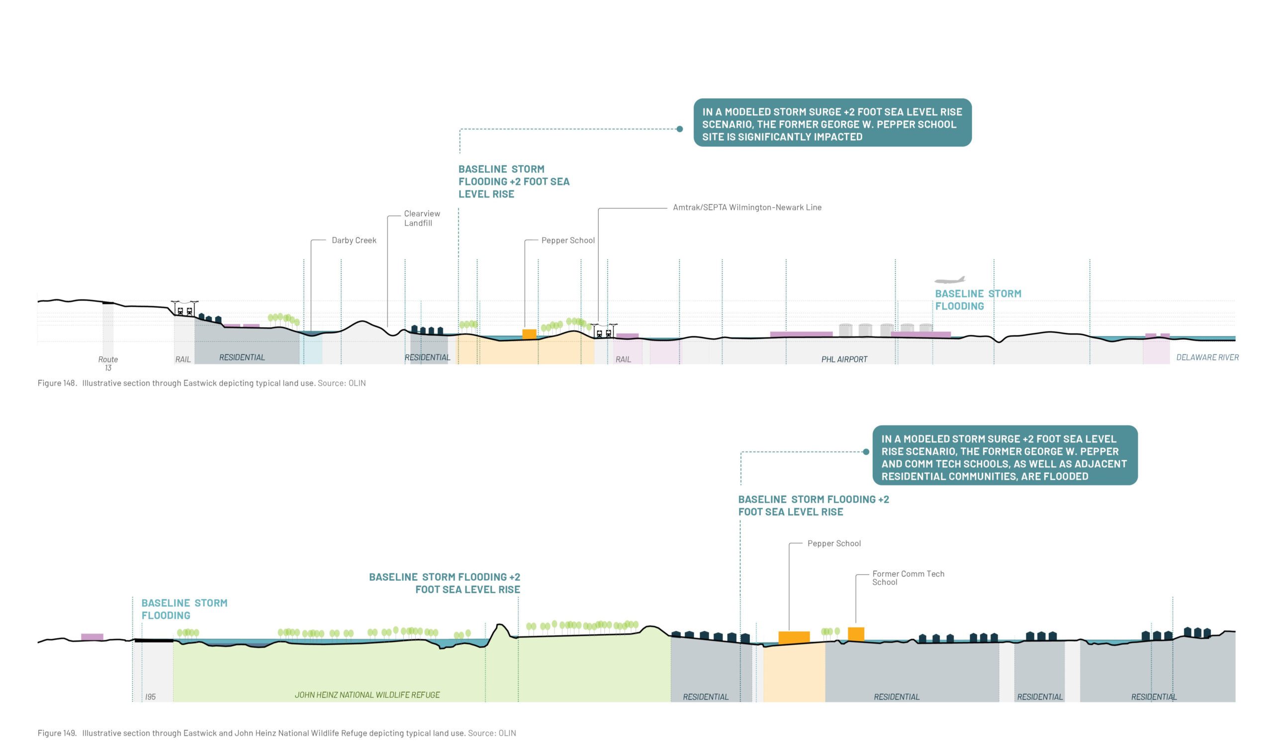
Eastwick is a low-lying residential neighborhoods adjacent to the Philadelphia International Airport and the John Heinz National Wildlife Refuge. Darby Creek cuts through Eastwick before joining Cobbs Creek to meet the Delaware River. The Clearview Landfill lies close to Darby creek, a residential pocket, and buildings that hold historical significance for the community.
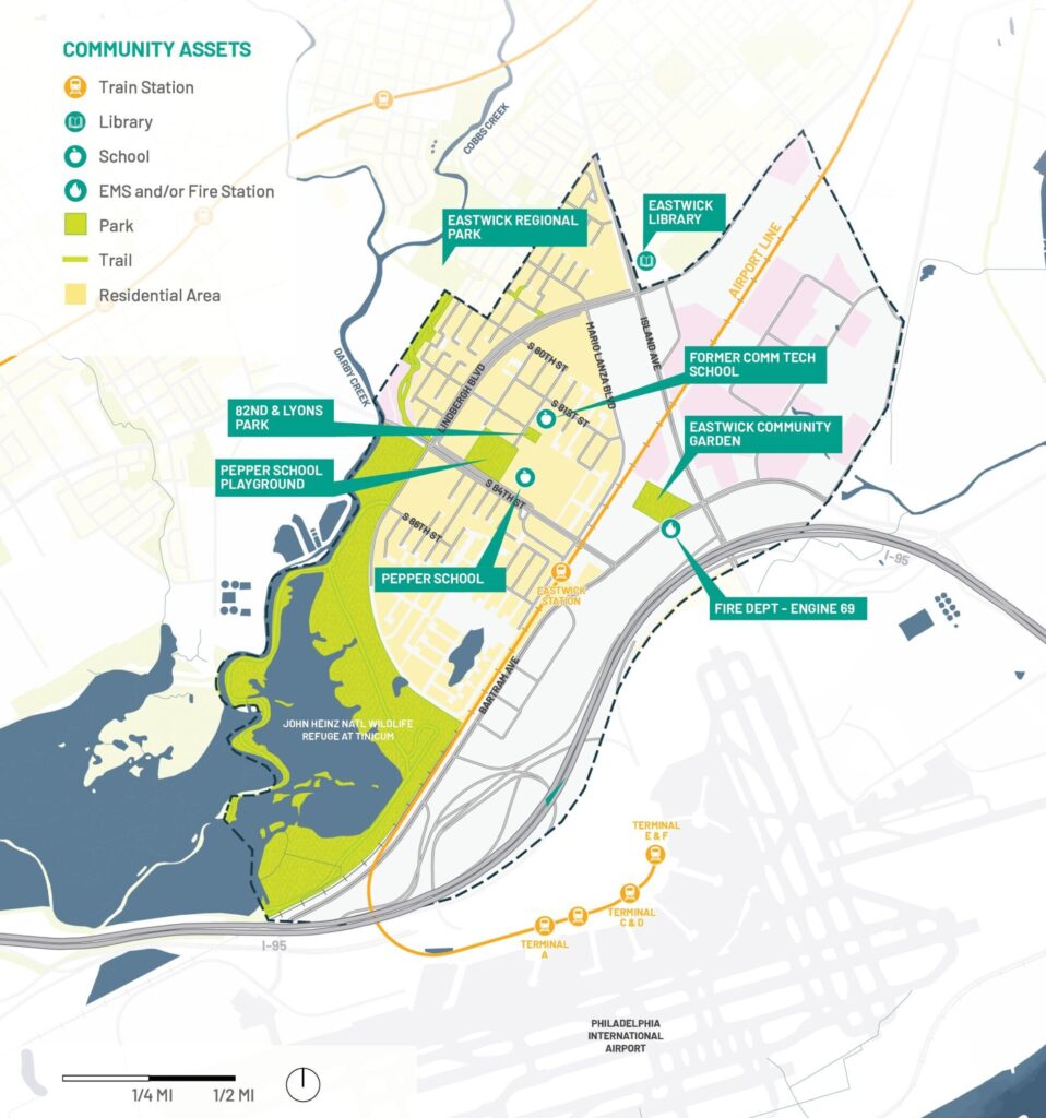
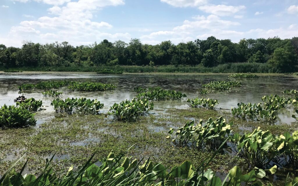
One of Eastwick’s largest community assets is also one of Philadelphia’s main assets: the John Heinz National Wildlife Refuge at Tinicum, located at the southern edge of the neighborhood. The 993-acre refuge has more than 10 miles of trails and is home to freshwater tidal marshes, open waters, and mudflats, all of which support passive recreation and wildlife habitats.
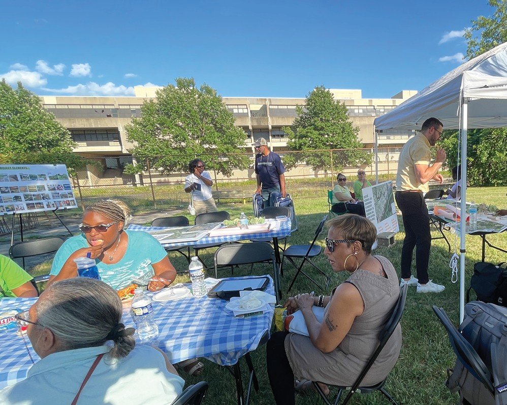
Within the neighborhood, other open space assets consist of Eastwick Park, an unused space adjacent to the Clearview Landfill, and the 7.5-acre Eastwick Community Garden. However, there is a shortage of play spaces in parts of Eastwick, particularly near the former Pepper School. Cultural assets include Cibotti Recreation Center and Eastwick Library.
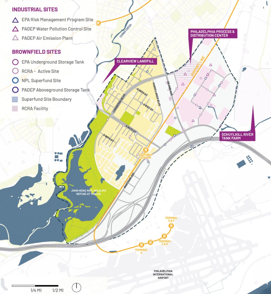
Although contamination risks are less visible in Eastwick than in nearby industrial communities, residents face ongoing exposure to air and noise pollution from Philadelphia International Airport, as well as concerns related to nearby fuel storage facilities and the former Philadelphia Energy Solutions (PES) refinery site.
Clearview Landfill/Lower Darby Creek Area Site
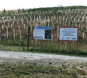
The Lower Darby Creek Area Superfund site includes two landfills: the Clearview Landfill and the Folcroft Landfill, the former of which is located in north Eastwick and abuts Eastwick Park and residential areas. The Clearview Landfill was once used for municipal and industrial waste disposal, operating without a permit from the 1950s – ’70s. Many homes were built on contaminated land, often without residents knowing the health risks. Soil contaminants include polychlorinated biphenyls, arsenic, pesticides, and heavy metals. Cleanup efforts are ongoing; the landfill has been capped and vegetated, and groundwater remediation is planned.
Sunoco Schuylkill River Tank Farm
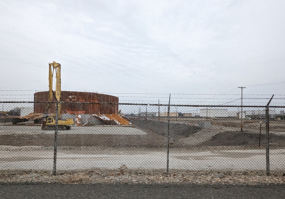
This 211-acre site, located adjacent to the Eastwick neighborhood, serves as a product storage and distribution tank farm. It stores and handles petroleum products, including gasoline and liquefied petroleum gas (LPG), for shipment and distribution.
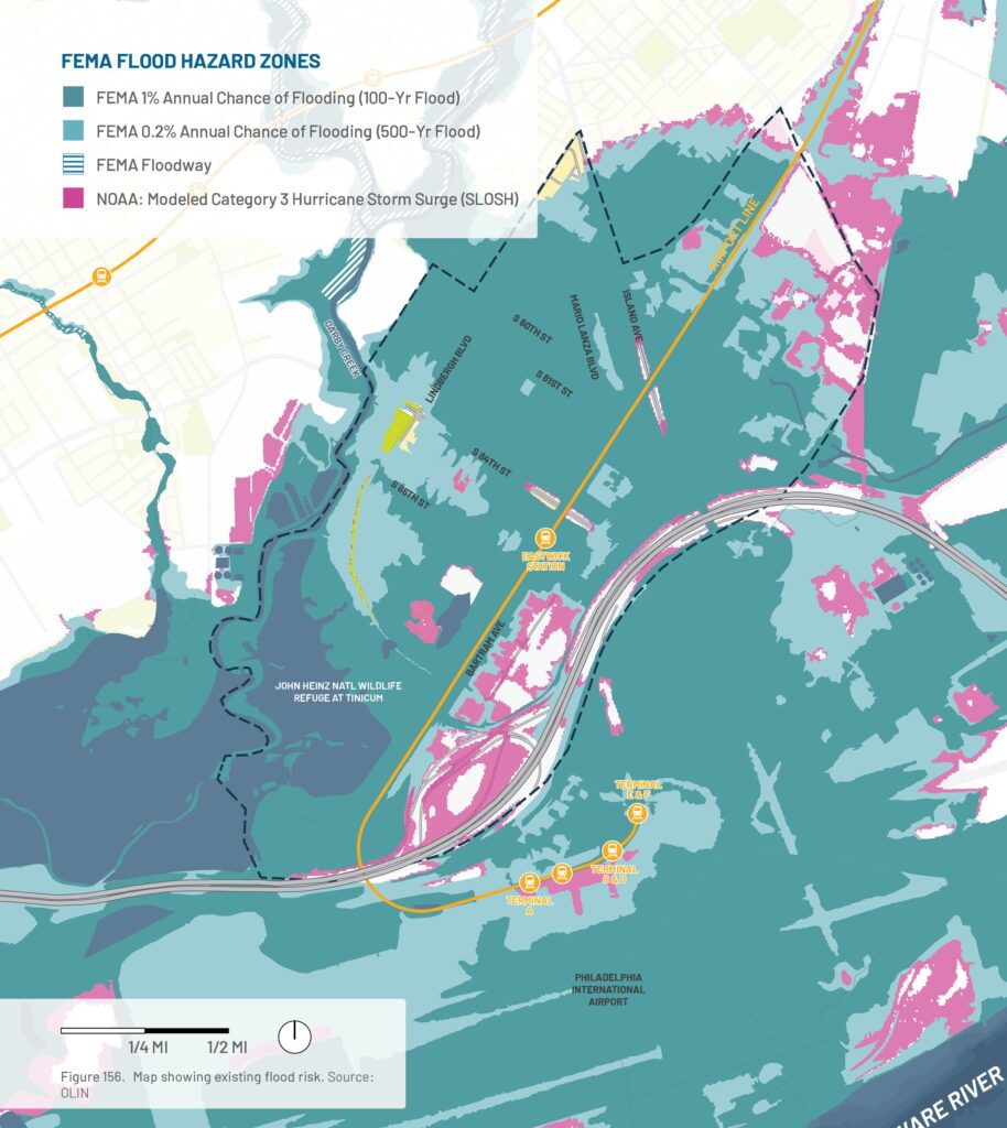
Flood Risk
Eastwick is Philadelphia’s lowest-lying and most flood-prone neighborhood, exposed to flooding from Darby and Cobbs Creeks, the Schuylkill and Delaware Rivers, storm surge, and heavy rainfall. Climate change is expected to worsen these risks through sea level rise and more intense storms.
Current Mapped Flood Risk
Most of Eastwick lies within FEMA’s 500-year floodplain, with substantial residential areas also located in the 100-year floodplain. The neighborhood is vulnerable to coastal storm surge from nearby waterways, while industrial facilities in northeastern Eastwick face heightened risks from flood-related hazardous material releases.
Flooding could also spread contamination from nearby sites, including the Philadelphia International Airport, the former Clearview Landfill, and two tank farms. Key community assets at risk include the former Pepper School and Playground, 82nd and Lyons Park, Eastwick Library, Eastwick Community Garden, Fire Engine 69, and the SEPTA Eastwick Regional Rail Station.
Extreme Heat
While Eastwick has more tree canopy than many Philadelphia neighborhoods, localized urban heat islands still create areas with higher-than-average temperatures. Climate change is expected to increase the frequency, intensity, and duration of heat waves, raising heat-related risks for residents and infrastructure.
Flood Analysis: Modeled Storms with Future Sea Level Rise
What community features and industry are at risk of current and future flooding?
The map illustrates a +2-foot sea level rise scenario combined with flooding from Hurricanes Ida (2021), Isaias (2020), and Sandy (2012). Light blue areas represent locations that likely flooded during these storms, while dark blue areas show additional areas that could flood under similar future storm conditions with higher sea levels.
While flooding from Darby and Cobbs Creeks affects much of Eastwick today, future sea level rise is expected to increase flooding primarily in the community’s southern and western areas through the Delaware River, John Heinz National Wildlife Refuge, and the Schuylkill River via Mingo Creek.
Rising sea levels also increase risks to low-lying industrial facilities and warehouses and may facilitate the spread of contaminants from nearby sites, including Philadelphia International Airport, the former Clearview Landfill, and surrounding tank farms. Stronger storms may further elevate risks through increased rainfall, flooding, and wind-related industrial accidents.
Grays Ferry
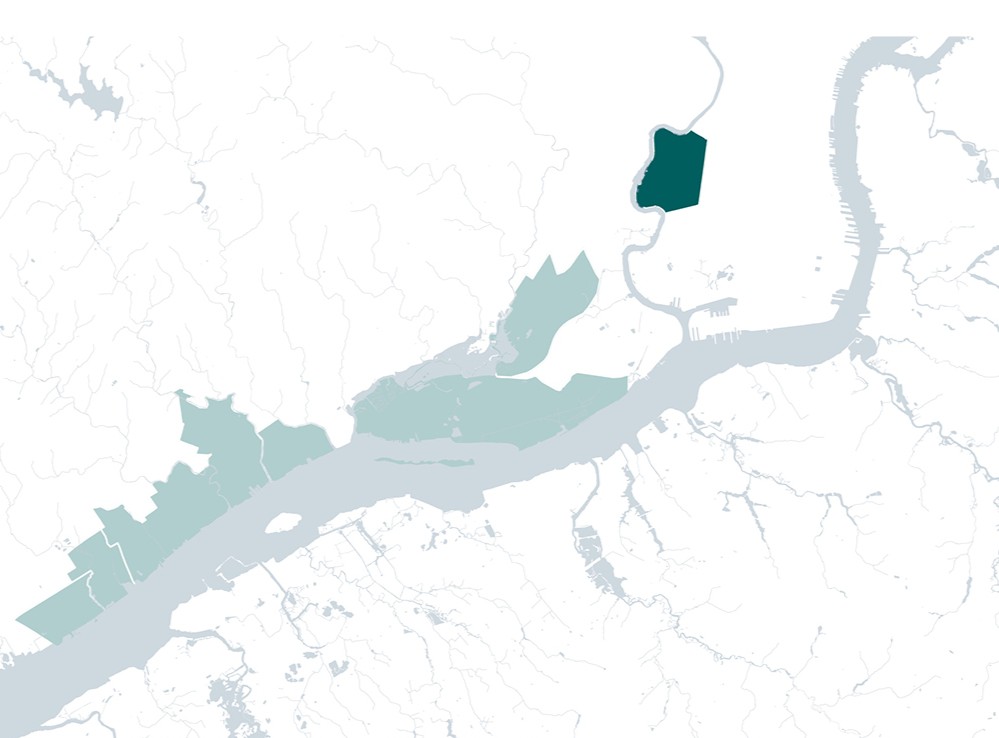
Grays Ferry is changing, but the legacy of health harms and contamination from the closed PES Refinery continue to plague the neighborhood.
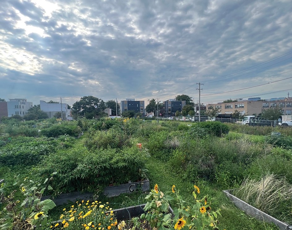
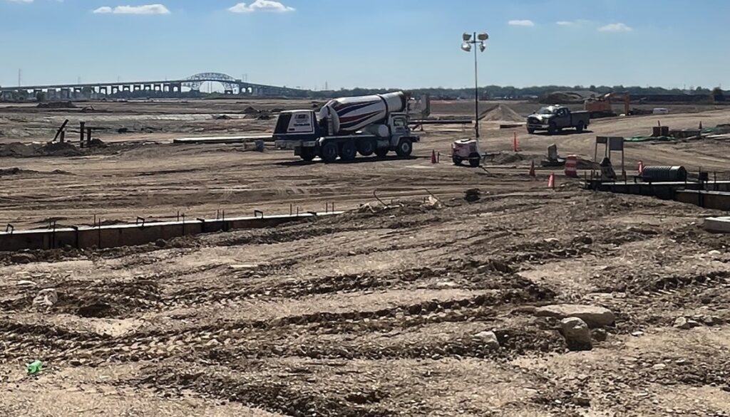
Grays Ferry, located along the eastern bank of the Schuylkill River, evolved from Lenni Lenape land into a key transportation and industrial hub in Philadelphia.
Once known for its pleasure gardens, the neighborhood became dominated by manufacturing and the nearby Atlantic Refining Company, later the Philadelphia Energy Solutions (PES) Refinery. While industry brought jobs and growth, decades of pollution contributed to serious health and environmental burdens for residents.
Significant investments in industrial sites around Grays Ferry should be coupled with fairly negotiated community benefit agreements that can help ensure new projects are healthier and more climate adaptive.
Grays Ferry by the Numbers
Population: 15,000
Density per square mile: 7,500
Median age: 34.5
Race and ethnicity: 54% non-Hispanic Black; 8% Hispanic
Income: 24% below poverty line
Land use: 30% open space; 14.8% industrial
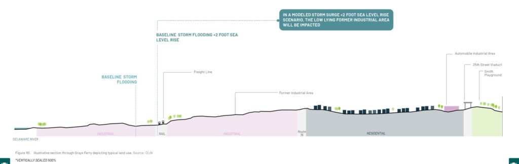
Grays Ferry has a large low-lying area where former industry once stood along the Schuylkill waterfront. A rail freight line cuts through this industrial zone which slopes upwards to a residential neighborhood which is flanked by Route 76 and the 25th Street Viaduct on either side. There are smaller parks that dot the neighborhood such as the Smith Playground.
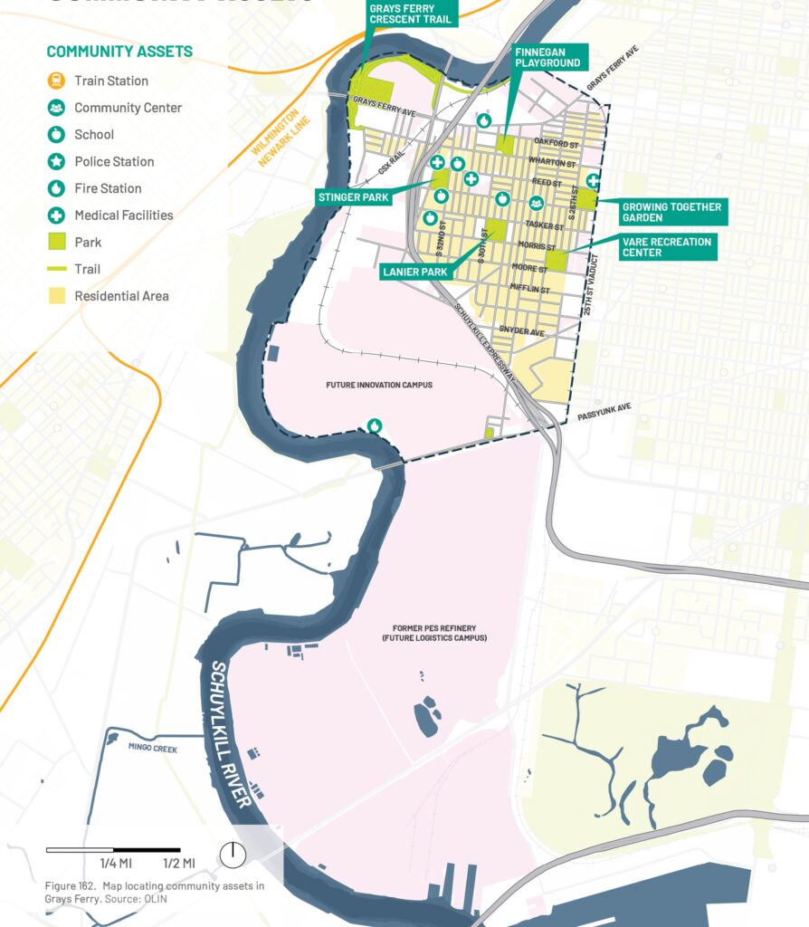
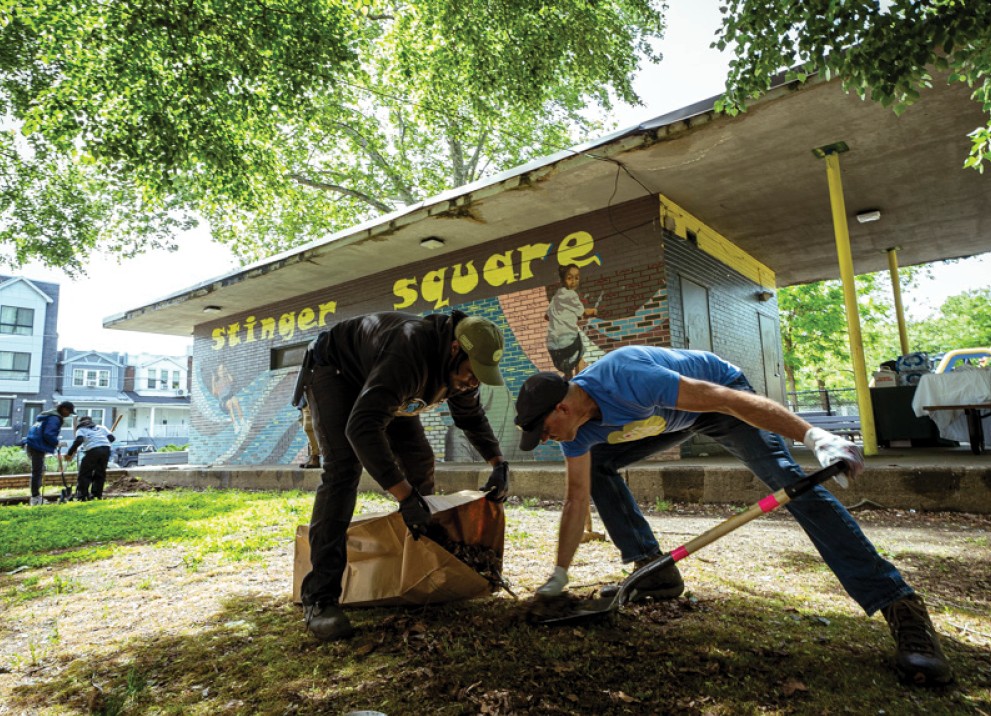
Grays Ferry’s parks—including Stinger Park, Finnegan Playground, Lanier Park, and Vare Recreation Center—serve as important community gathering spaces. A recent $20 million Rebuild investment upgraded Vare’s recreational facilities.
The neighborhood also benefits from the Grays Ferry Crescent Trail, which transformed former industrial land into waterfront park space with trails, fishing, and recreation areas. New trail connections are improving access to Center City and Bartram’s Mile, addressing long-standing concerns about isolation.
Looking ahead, redevelopment of the former PES Refinery site may create additional waterfront open space, though public access and neighborhood connectivity remain uncertain.
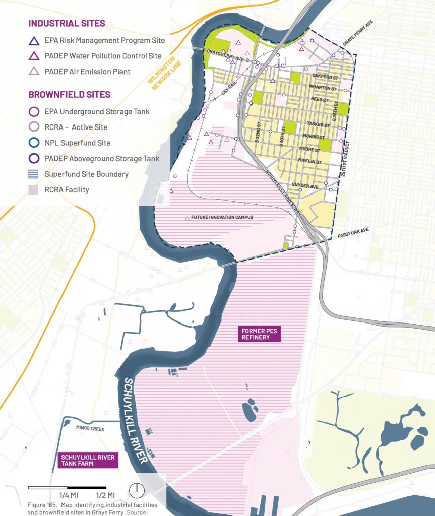
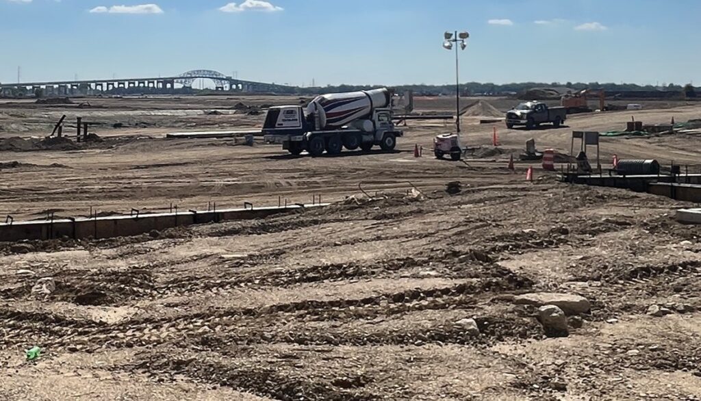
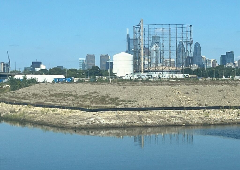
The former 1,300-acre PES Refinery—now being redeveloped as the Bellwether District—has long shaped Grays Ferry’s industrial identity.
For over 150 years, petroleum refining and storage activities contaminated local air, soil, and water, contributing to significant environmental and public health concerns.
Despite remediation efforts begun in the 1990s, the full extent of contamination remains uncertain. Current owner HRP Group plans to redevelop the site by capping contaminated soils, raising ground elevations, and incorporating flood-mitigation measures.
While redevelopment offers economic opportunities, ensuring long-term environmental safety and community health remains a critical challenge.
Flood Risk
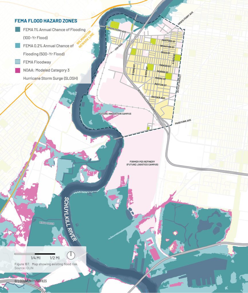
Flooding in Grays Ferry is mostly fluvial, when large storm events produce heavy rains upstream causing the Schuylkill River to overflow its banks. Due to its large areas of impervious surfaces, inland flooding is also possible where water collects in low-lying areas or can’t drain fast enough through the storm drain network. Sea level rise may lead to some minor increased flooding along the Schuylkill River.
Current Mapped Flood Risk
The Federal Emergency Management Agency’s flood hazard areas are limited to areas along the Schuylkill River with some possible impacts along 34th Street and the freight rail line adjacent to the river. Much of the adjacent former Refinery site is located in the river’s floodplain and is being elevated with fill. Additional studies are needed to determine how changing these floodplains may offset flood waters to other areas, increasing flood risk elsewhere.
Extreme Heat
With only 5.5% tree canopy, extensive impervious surfaces, and nearby pollution sources, Grays Ferry experiences elevated temperatures from the urban heat island effect. Climate change is expected to intensify these conditions, bringing more frequent and prolonged heat waves.
Modeled Storms with Future Sea Level Rise
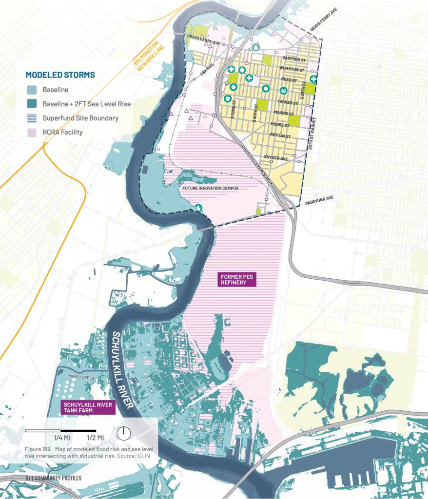
Generally, the Grays Ferry neighborhood is elevated enough to not be significantly impacted by sea level rise. Of the baseline storm events, Hurricane Ida (2021) produced the most flooding in Grays Ferry, however the addition of 2 feet of sea level rise would mostly only increase flooding along the Schuylkill River south of Grays Ferry Avenue.
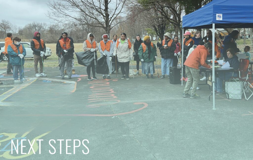
Recommendations for next steps are organized by community and across three scales: community/local, regional, and policy. Each scale includes complementary actions that strengthen climate resilience, from emergency preparedness to fostering social connections. Because no single approach can address all challenges, effective resilience depends on coordinated solutions across all scales.
Communities are all at different starting points in their journey towards becoming more environmentally just and better adapted to climate change.
Local, near-term projects that the community can pursue with or without municipal support.
Larger, more complex projects that require coordination and planning across multiple jurisdictions and sectors.
On the policy level
Recommended changes to laws, regulations, and planning.
Local, near-term projects that the community can pursue with or without municipal support.
On the regional level
Larger, more complex projects that require coordination and planning across multiple jurisdictions and sectors.
On the policy level
Recommended changes to laws, regulations, and planning.
Local, near-term projects that the community can pursue with or without municipal support.
On the regional level
Larger, more complex projects that require coordination and planning across multiple jurisdictions and sectors.
Note: Since the completion of this report, the U.S. Army Corps of Engineers determined that a proposed levee project in Philadelphia’s Eastwick neighborhood is not feasible.
On the policy level
Recommended changes to laws, regulations, and planning.
Local, near-term projects that the community can pursue with or without municipal support.
On the regional level
Larger, more complex projects that require coordination and planning across multiple jurisdictions and sectors.
On the policy level
Recommended changes to laws, regulations, and planning.